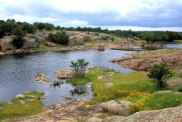
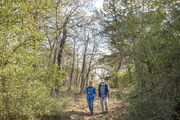
On a clear January day, Mike Conner and I walk down the sandy road that crosses his Milam County property, roughly halfway between Temple and Bryan. Our steps are muffled by the carpet of fallen leaves, and cardinals chip-chip to one another in the post oaks overhead. We turn off the road and walk up a slight rise to a trail marker where the path narrows slightly, as yaupon holly thickets encroach on both sides.
The next part of the trail, Conner explains, is an actual swale — a shallow, U-shaped depression worn into the earth by years of foot traffic. The two of us are hiking a stretch of El Camino Real de los Tejas, a historic thoroughfare that stretches from today's Mexico into Louisiana. “We're walking on a trail that was made over hundreds of years and may have been used for thousands,” Conner says.

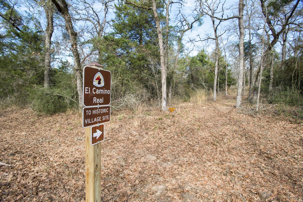
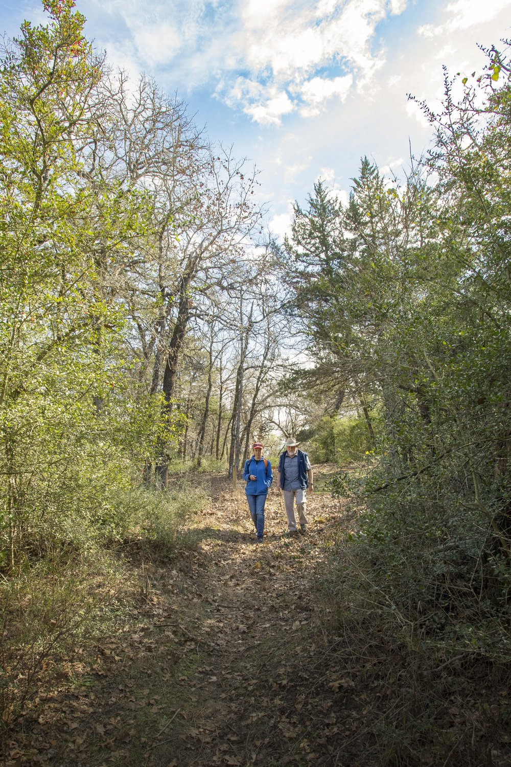
The trail leads through the woods and down a swale created by human and animal foot traffic.
The trail leads through the woods and down a swale created by human and animal foot traffic.
This particular trek is a 1.1-mile stretch of the Camino that Conner and his wife, Joyce, and their neighbors, Eugene and Elaine Baumann, have named “Walk the Rancheria Grande.” It's one of just a handful of places where Texans can literally follow the footsteps of those who walked the Camino hundreds of years ago.
The Camino Real — or Royal Road — reached north from Mexico City, the capital of New Spain, to Los Adaes, the first capital of the province of Texas (near today's Natchitoches, Louisiana). The route began as a loosely connected web of Native American footpaths. In the late 1600s, the Spanish used these paths for expeditions to find French explorer René Robert Cavelier, Sieur de la Salle, in hopes of expelling him and his men from territory the Spanish considered their own. The Spanish also established missions and presidios along the trail route. Later, white settlers from the United States traveled into Texas via the Camino. In 2004, Congress designated El Camino Real de los Tejas a National Historic Trail administered by the National Park Service. The NPS's map of the Camino showed it running right through the Conners' property.
But the Conners didn't know this at first. The couple had purchased the land in 2003, hoping to spend their retirement protecting the environment. Their initial project was fighting the dense yaupon holly understory that had overtaken the post oak savannah on most of their 703 acres. In partnership with Texas Parks and Wildlife Department biologists, they beat back the yaupon with mechanical mulching, herbicide and controlled burns. The improved habitat will likely allow for eventual reintroduction of the endangered Houston toad.
Then, in 2015, the Conners learned that a draft of the state water plan included a reservoir that, if built, would submerge most of their and their neighbors' property. They began to scour their land for endangered species or archeological sites — any resources that would warrant protection and could help block the project. Milam County historian Lucile Estell, who had been active in the nonprofit El Camino Real de los Tejas National Historic Trail Association, encouraged the Conners to research whether the trail crossed their property. In particular, Estell suspected their land might be part of the Rancheria Grande, a peripatetic encampment of 23 Native tribes along the trail that facilitated trade and cultural exchange. Spanish priests and explorers had written about the rancheria, but its exact location was unknown.
The Conners invited Steven Gonzales, the executive director of the El Camino Real de los Tejas National Historic Trail Association, to visit. As their vehicle bumped slowly down the road, Gonzales spotted what looked like a swale nearby. Years of searching for remains of the Camino had taught him to recognize the distinctive ditches (such experts are known in the field as “rut nuts,” he says). Finding a previously forgotten piece of the road is always exciting, Gonzales says. “You think, ‘Are we discovering something that no one knew was here?'”
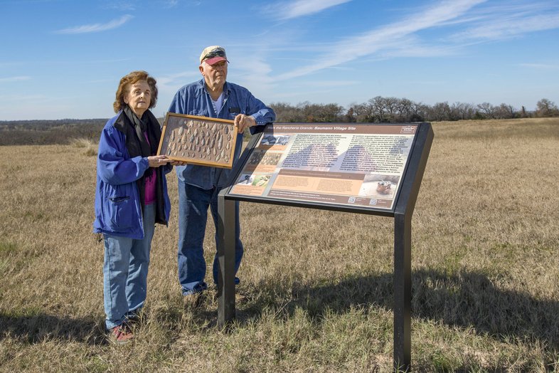

Eugene and Elaine Baumann have collected numerous projectile points on their property.
Eugene and Elaine Baumann have collected numerous projectile points on their property.
Subsequent archeological excavations there produced a fragment of metal that dated from the Spanish colonial period and had been made into a projectile point, presumably by a Native person. This evidence confirmed that the swales had been used during the period when both Native people and Spanish explorers were traveling the Camino Real.
The Baumanns, whose property abuts the Conners', had for years collected projectile points as well as stone tools that had been used for grinding acorns and cooking. Additional excavations, coupled with historical research, determined that the Baumann and Conner properties were both part of the Rancheria Grande, and a hilltop on the Baumanns' land was the site of a rancheria village.
Excited about what they'd learned, the Conners started leading informal walks along the Camino to the Baumann village. With the Baumanns, they decided to make the hike an official trail. Beginning in 2022, the Conners worked with the National Park Service's National Historic Trails division and the El Camino Real de los Tejas association to create interpretive panels and a trailhead map. On Oct. 19, 2024, the two families and several dozen guests celebrated the opening of the Walk the Rancheria Grande trail. The Conners maintain a website that allows one small group per day to register and receive the gate code for the free hike (closed May 15-Sept. 15).
On our January adventure, Mike Conner and I emerge from the swale pathway into a clearing and pass through a pedestrian gate into the Baumanns' property. Soon we find ourselves at the base of a tall, mostly treeless hill. The grade is so steep that, as we begin to climb, all we can see above us is sky. When we reach the summit, the hilltop opens before us, and we pause to take in the expansive view.
The reservoir that spurred the Conners and Baumanns to action was never built. But the Walk the Rancheria Grande trail that resulted from their efforts is a valuable resource for both historians and outdoor enthusiasts. With the vast majority of Texas land in private hands, the only way remnants of the Camino Real de los Tejas will be preserved is through the voluntary cooperation of landowners. Elaine Baumann, whose family has lived in the area for a century, said she's happy to be part of that effort. “It's nice for people to get out of the city and come appreciate it,” she says.