I frequently feel as if I am stuck in a concrete jungle.
I am a dedicated outdoors person who resides in Houston, which happens to be the largest city in a large and populous state. I frequently find myself looking for hikes where I can stretch my legs, enjoy a bit of fresh air and hear breezy bird songs — within the confines of the city. Most of us live in cities, and, believe it or not, our urban jungles do have trails.
With travel calling me to the five points of the Lone Star State in recent months, I have been fortunate to happily roam along many urban trails across Texas. Not only have these city hikes provided exercise and boosted my vitamin D levels but they also offered a pathway to enjoy the natural world in different regions of the state. From wetland complexes of the South Texas plains to the desert mountains of West Texas, tackling these city hikes has allowed me to learn about the human history and cultures of our vast and varied municipalities.
Let me offer a caveat that this is not a “best of” list, and that’s a good thing. The cities of Texas have a lot to offer explorers, including wildlife preserves, state parks and even national park properties. My efforts to keep in the outdoor groove reflect more of a getting-to-know than an insider’s guide to these cityscapes. Whether the goal is counting steps, looking for birds and wildlife or taking a break from daily routines, you’ll find something special along all these trails.
El Paso
Franklin Mountains State Park
ROUTES: West Cottonwood Spring; Ron Coleman
LENGTH: 3 miles, out and back; 3.5 miles one-way
DIFFICULTY: Moderate; challenging
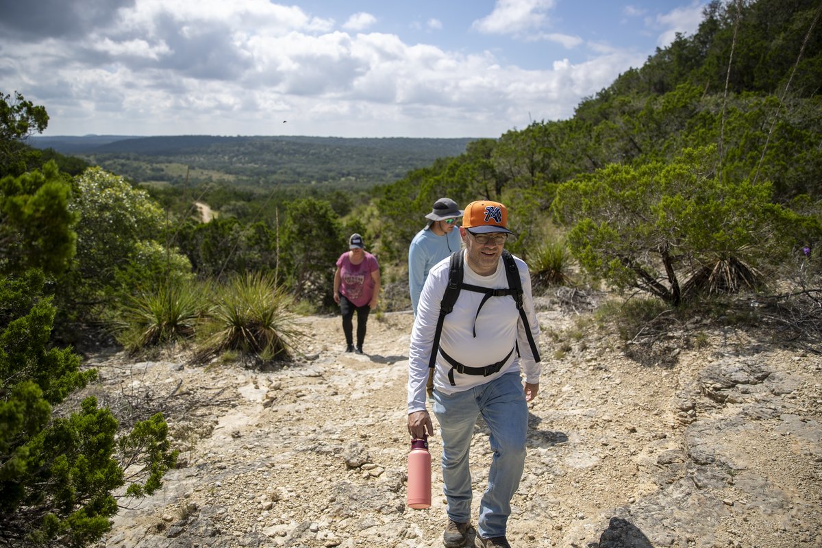
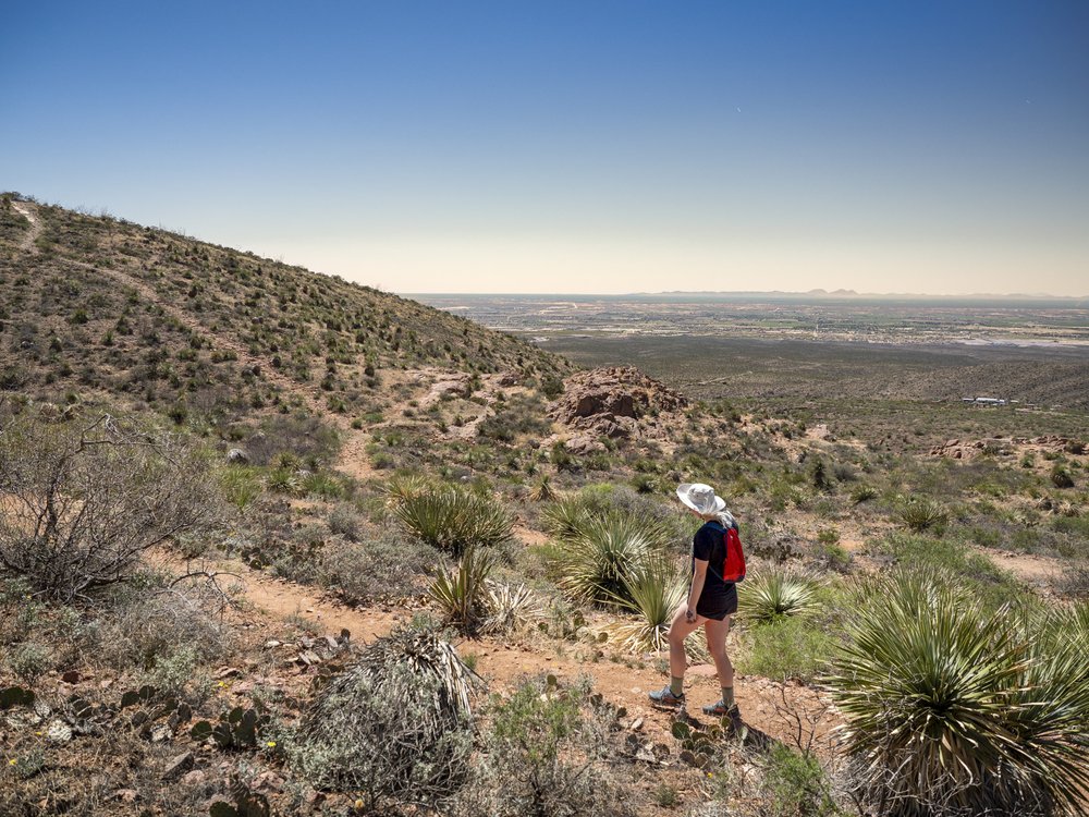
With almost 27,000 acres to explore, Franklin Mountains State Park is more than 30 times bigger than Central Park in New York City. In fact, located entirely within the city limits of El Paso, the state park is the largest urban wilderness not just in Texas but one of the largest urban wilderness parks in the world. Boasting more than 120 miles of multiuse trails spanning a Chihuahuan Desert landscape that rises rises up to 7,000 feet above sea level in some areas, the toughest challenge can be simply picking a hike. But after several visits riding and hiking the state park, first occupied by Native Americans almost 12,000 years ago, allow me to make two suggestions.
The first, the West Cottonwood Spring Trail, is an excellent introduction leading to scenic Mundy’s Gap. From above the visitor center, it climbs about 1,000 feet over about a mile and a half, passing some old mining operations. The trail network can be a bit confusing, so carry a map and note the trail markers along the way.
For those looking to better experience the high country, the Ron Coleman Trail (named for the Texas congressman who fought to preserve the park) is a beefy hike over steep grades that crosses the 6,800-foot South Franklin Mountain. Trust me, you’ll need to be in good shape for this adventure — and whether you begin or end at Smuggler’s Pass off Transmountain Road, be sure to arrange a shuttle. For tenderfoots, there are plenty of lower elevation hikes to pick from that serve up just as much splendor.
San Antonio
El Camino de San Antonio Missions
ROUTE: Mission Espada >
San Fernando Cathedral
DIFFICULTY: Moderate
LENGTH: 8 miles one-way for Mission Reach; 10 miles one-way for the entire Camino

Mission Reach in San Antonio.
Maegan Lanham
Mission Reach in San Antonio.
Maegan Lanham
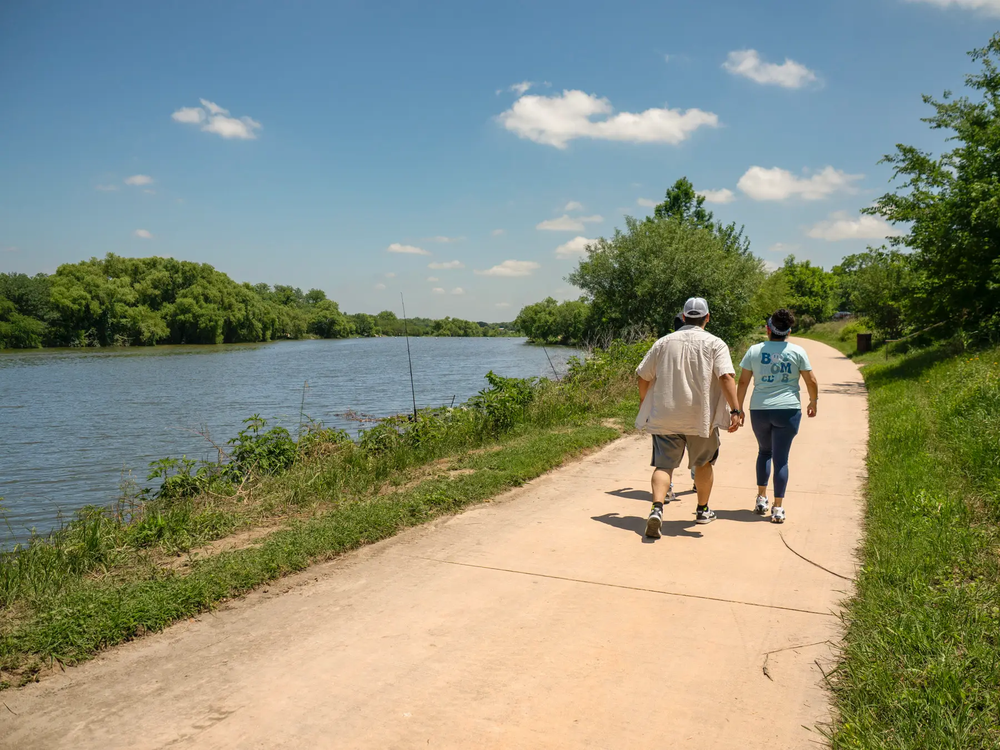
It's a bright and beautiful day along the Mission Reach, a section of the San Antonio River south of downtown, where an 8-mile section of the river has been the focus of one of the largest ecological restoration projects in the nation. A combined effort between the Texas Parks and Wildlife Department, the San Antonio River Authority, the U.S. Army Corps of Engineers and other partners, 400 acres of native habitat have been restored with native landscaping, public art installations and trails over several phases.
I start at the southernmost point, Mission Espada, the first Spanish mission in Texas, which is also part of the San Antonio Missions National Historic Park. Along a broad, ADA-compliant concrete pathway that accommodates hikers and bikers — and links several canoe and kayak launches for paddlers and anglers — I find the restoration efforts along Mission Reach impressive. Herons and egrets wade the waterway, a belted kingfisher cruises the shoreline, and I enjoy public art displays including a massive steel tree-of-life sculpture by artist Margarita Cabrera aptly titled Árbol de la Vida: Memorias y Voces de la Tierra.
On my way north from Mission Espada, I detour to take in the acequias, a system of aqueducts and irrigation canals built by the Spanish with help from some of the region’s Native Americans. Four more missions along the way, managed by the local Catholic archdiocese, complete San Antonio’s popular El Camino de San Antonio Missions trail.
Although I am not Catholic myself, I am fascinated to learn that pilgrims who complete an extended route from Mission Espada to the San Fernando Cathedral downtown can receive 30km credit towards the Camino Ingles (English route), an official route of Spain’s famous El Camino de Santiago. To do so, they must pass through the necessary portals along the way — each historic mission access point is marked — and get a passport from the Padre Margil Pilgrimage Center next door to Mission Concepción. Meanwhile, after 11 miles, I do reach downtown and find my own spirit lifted by the walk.
Austin
McKinney Falls State Park
ROUTE: Homestead Trail
LENGTH: 3.1 miles, loop
DIFFICULTY: Moderate

Crossing the creek at McKinney Falls State Park.
Sonja Sommerfeld
Crossing the creek at McKinney Falls State Park.
Sonja Sommerfeld
I tumble like Falstaff across Onion Creek, watching a red-tailed hawk soaring overhead, and hear the splashing water of the falls. Once across the water, with one shoe damp from a misstep along the fluted limestone of the lower McKinney Falls, I duck into the woods and remember what a gem the park is. The Lower Falls are a popular spot for families to explore (it’s always best to watch for potential flooding from rain upstream).
About 13 miles south of the state Capitol, McKinney Falls has over nine miles of trail. The Homestead Trail passes an old stone house as it climbs into mixed Hill Country woodlands boasting a mix of oak and juniper. Both the house and a former mill, destroyed in an 1869 flood, were built by enslaved people for park namesake William McKinney, and represent just one chapter in the park’s history. Though there is little evidence left as you traverse the land, the area has been occupied for nearly 9,000 years; during the 18th century, a portion of El Camino Real de los Tejas between Mexico and Louisiana ran along Onion Creek.
I face a few quick ups and downs along the twisting Homestead Trail, keeping an eye out for wildlife such as armadillo, gray fox and white-tailed deer. At the far end, the trail connects with a couple of spurs if you have the time and then loops back along the fence that splits the park from the TPWD HQ complex. With plenty of shade, and the creek waiting, it makes for a super weekday excursion year-round. With 81 electric and water campsites, you can even stay overnight, although on weekends you’ll want to reserve ahead for day use and camping. Either way, I have to envy my Austin colleagues who get to visit the park whenever they want.
Dallas
Cedar Ridge Preserve
ROUTE: Possumhaw > Cedar Brake > Fossil Valley > Escarpment > Bluebonnet
LENGTH: 5.5 miles, loop
DIFFICULTY: Challenging
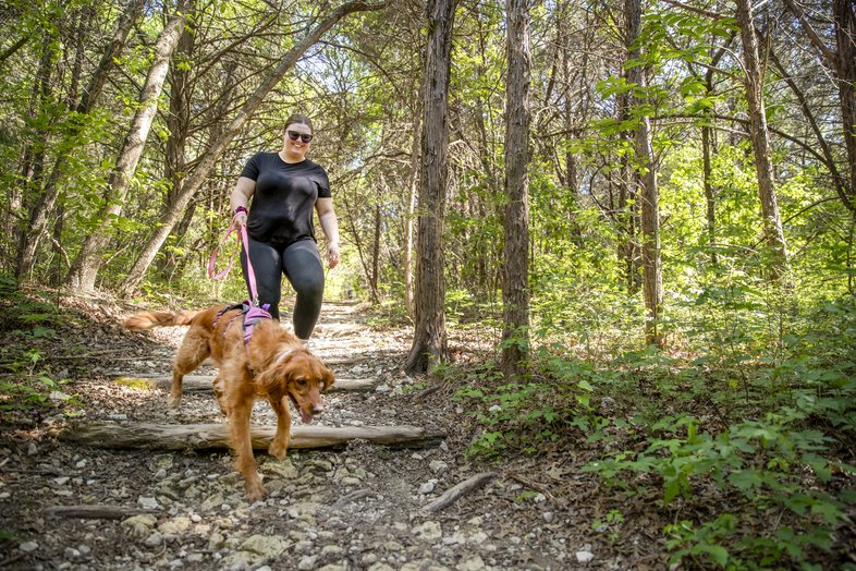
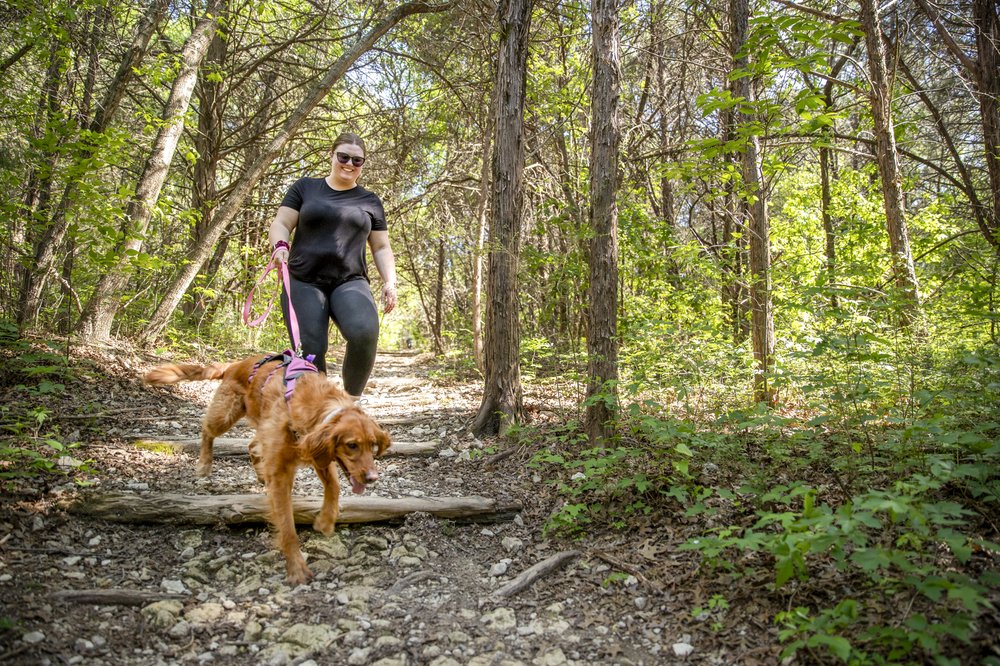
Hiking the trails at Cedar Ridge.
Maegan Lanham
Hiking the trails at Cedar Ridge.
Maegan Lanham
The 600-Acre Cedar Ridge Preserve may very well be my favorite discovery. Judging from the crowded parking lot, I am far from alone in my appreciation. Happily, once I start walking, the crowds dissipate along the trail, which weaves in and out of several steep ravines while visiting a mix of woodland, prairie and even a small wetland surrounding the picturesque Cattail Pond. Using AllTrails as my guide, I tackle the outer loop in a clockwise direction accompanied primarily by the sound of bird song. From the preserve map, I see I have more left to explore.
Of course, North Texas doesn’t have real mountains, but I find the ups and downs along Cedar Brake Trail and Fossil Valley fairly demanding. These rolling hills don’t slow down the occasional trail runner huffing by me on the uphills — some sections of trail have been adopted by the North Texas Trail Runners. In addition to the athletes, I spy many family groups making the most of the natural areas. Signs speak to the presence of assorted venomous snakes, not to mention black-capped vireos, and Audubon Dallas has incorporated the preserve into the National Audubon Society’s strategic plan to protect songbird habitat across the country.
Coming around my last segment, I climb the Bluebonnet Trail viewing platform and enjoy a panorama including the broad vista of Joe Pool Reservoir. Next, as I return to the start, I overhear a little girl tell her parents “I love hiking. We need to hike more.” Point taken.
Houston
Willow Waterhole Greenway
ROUTE: Greenway Trails
LENGTH: 5.7 miles, around multiple lakes
DIFFICULTY: Easy

Hiking and biking at Willow Waterhole.
Chase Fountain
Hiking and biking at Willow Waterhole.
Chase Fountain
For me, Willow Waterhole is my hometown trail — but most people in Houston don’t even realize we have such a fine trail network so close to the southwestern edge of the 610 Loop. Willow Waterhole is a community project born of the need for improved stormwater retention across the Brays Bayou watershed. The Harris County Flood Control District teamed up with neighborhood activists, the Houston Parks and Recreation Department, TPWD and the nonprofit Willow Waterhole Greenspace Conservancy to design a scenic natural area. The basin serves as a catchment when heavy rains fall (including in 2017 when Hurricane Harvey hit). For years, I have routinely walked shorter circuits around the restored habitats of Westbury Lake and Prairie Lake, and now that all the sections are complete and signed for easy navigation, I challenged myself to a longer hike.
Some purists may scoff at hiking on pavement, but the Willow Waterhole has plenty of ecological amenities that help me forget — if only periodically — how land use in Houston has for so long been defined by a lack of zoning and an abundance of roadways across the sprawling city. The paved trails are ADA-compliant, and the pleasant, tree-lined pathways offer access to nearly 300 acres of native prairie and rejuvenated wetlands. Indeed, Houston Audubon hosts a monthly bird survey, regularly logging over 200 species.
With spring bluebonnets in full bloom, I cover nearly six miles out of the eight available around Willow Waterhole. Then I head for the nearest taco truck to refuel, trusting I’ll be back soon.
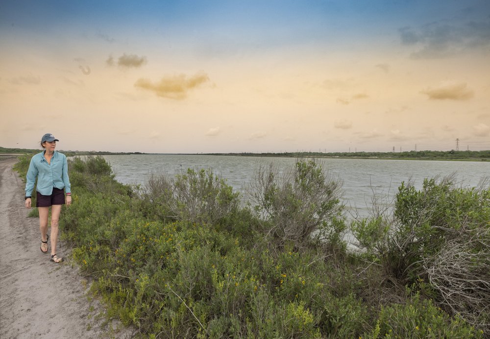
Corpus Christi
ROUTE: Oso Loop
LENGTH: 2.2 miles, figure eight
DIFFICULTY: Easy

Walking along Oso Creek.
Sonja Sommerfeld
Walking along Oso Creek.
Sonja Sommerfeld
The multiuse trails of Oso Creek are tucked behind a residential neighborhood about halfway between the South Texas Botanical Gardens and Oso Bay Wetlands Preserve. I visited these trails with my daughter during her spring break. Though Corpus Christi may not be known as a hiking destination, I find the natural, 200-acre setting to be a breath of fresh air as we travel along Oso Creek, which runs along the west side of town draining into shallow Oso Bay in the heart of the Coastal Bend. There’s a dedicated monarch waystation, provided by the nonprofit Monarch Watch; other signs of wildlife included raccoon and deer prints along the banks of the creek.
Despite the water woes of Corpus Christi, Oso Creek remains a birdy oasis with roseate spoonbills and white pelicans among the avian visitors. Following the mesquite-lined dirt trail to the waterfront, we pass a man doing maintenance along the disc golf course, and encounter a family on mountain bikes zipping along the swooping natural paths. In the fall, the area sees a plethora of migratory bird action, including kettles of raptors following the coastline down the Gulf. The famous Hawk Watch Tower at Hazel Bazemore Park is across town. Returning to our car, I note a dedication to Art Norman, a local mountain biker, who “adopted” the park about a dozen years ago. As development continues to advance toward these critical wetlands, I hope the community recognizes the rough gem here.
The main entrance to the trails is at Oso Creek Trailhead Parking, at the end of Salsa Drive. At the time of writing, the lot was under construction with no parking or access to park. If this is the case when you visit, there are alternative entrances at the southern end of Bear Creek Hike and Bike Trail (parking at Cimarron Park) near the monarch waystation, and through the Oso Creek Park Disc Golf Course on Safety Steel Drive (also has parking).