Prairie dogs are not traditionally beloved by ranchers. They eat down the available forage surrounding their “town,” leaving less for livestock. But when the Smokehouse Creek Fire blazed through the Gene Howe Wildlife Management Area in February 2024, it was thanks to the prairie dogs that any cattle survived at all.
“There were 60 head of cattle in that pasture, and it was all fenced in,” says TPWD wildlife biologist Brody Larkin. “I was fully expecting to have lost all 60. But when I got there, they were drinking out of the trough. I saw that parts of the prairie dog town didn't burn because of how short the grass was, so my explanation for that was the cows went to the prairie dog town and waited out the fire. The prairie dog town saved the cattle.”

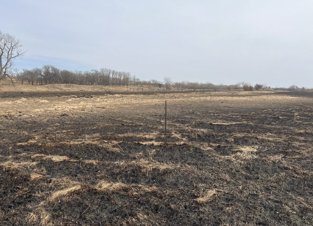
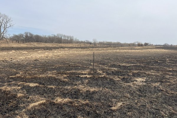
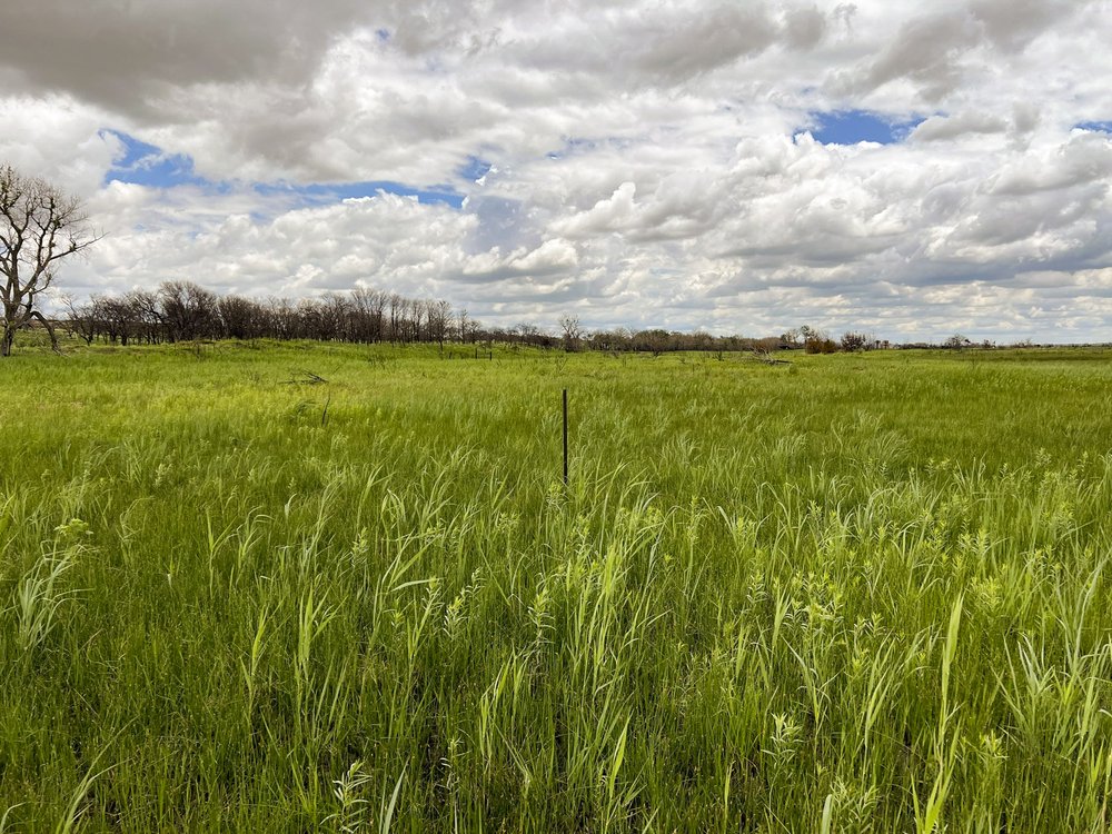
Prairie dog town at Gene Howe.
Prairie dog town at Gene Howe.
The fire burned almost every inch of the WMA except for the dog town, killing old trees and reducing the sagebrush scrub to ash. In total, the fire scorched more than 1 million acres across Texas and Oklahoma.
As the blaze approached, WMA technician Blaine Nunley leapt into action, creating fire breaks to save infrastructure. Thanks to his efforts, only one barn was lost.
“The first day after the fire, there were a lot of signs of hope,” says Larkin. “We had quail running around everywhere, deer running around everywhere, all kinds of birds flying around. And this is where we found out that we had pileated woodpeckers.”
In the year since, the WMA has recovered well. The sage and bluestem are back on the sandy hills, and Larkin has been taking progress photos to show the regrowth.
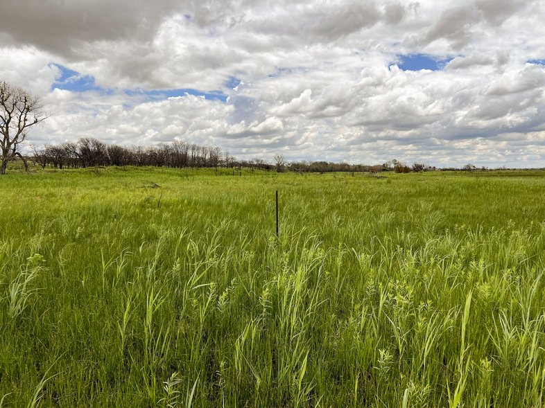
West Bull Pasture shows regrowth two months after the fire.
West Bull Pasture shows regrowth two months after the fire.
An Oasis on the Plains
The Gene Howe WMA offers a unique slice of the eastern Panhandle. The property is split into pastures on either side of FM 2266. On the northeast side of the road, sage-covered hills offer sweeping views of the countryside. On the southwest side, the Canadian River valley is lush with cottonwoods and grasses. A network of sloughs provides excellent fishing and bird-watching.
“It's a place for the public of Texas to come out and enjoy, in my opinion, one of the most beautiful parts of the state,” says Larkin. “Prepare to see a diversity of wildlife and plant life that you wouldn't think would be in the Panhandle.”
The Gene Howe WMA was named for the late Eugene “Gene” Alexander Howe, a Lubbock journalist who became famous for his column “The Tactless Texan.” Howe was also a passionate conservationist and was instrumental in establishing the WMA.
The WMA provides opportunities for research on quail, plants and prairie dogs (read more about the prairie dog research on Page 24), and also welcomes visitors. “We have a lot of people who come to fish, hike, bird-watch and just view wildlife, and that all falls under our limited use program,” says Larkin.

What to Do
Hike
There are no designated hiking trails at the WMA, but “you can go anywhere on foot that you'd like to go,” says Nunley. “I like walking down the sloughs to watch the birds and wildlife you see down there.”
Fish the Sloughs
The WMA offers plenty of fishing opportunities along its network of sloughs. The sloughs are home to largemouth bass and bluegill, with the occasional crappie. The WMA has recently begun stocking channel catfish in the sloughs.
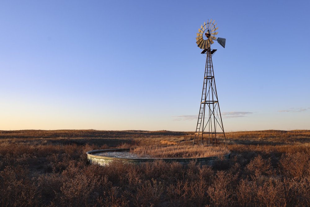
Catch the Sunset at Mill on the Hill
“My favorite spot on the property is Mill on the Hill,” says Larkin, referring to a solar windmill located on a high point that overlooks almost the entire WMA. “It's just an area that you get to really take in the full beauty of this place. And it's one of those places that, on my own time, I'll go out there and sit and just relax.” You can access Mill on the Hill by taking the first right in the DeArment pasture, either in a four-wheel-drive vehicle, on a bike or on foot.
Camp
Tucked in a glade of trees, three shaded shelters and six open sites with fire rings are first-come, first-served. Turn off FM 2266 at the sign that reads “Hunters Camp.”
Hunt
The WMA offers several opportunities for hunters. You can walk in to hunt for dove, quail and waterfowl in their respective seasons, or bow-hunt for feral hogs each March. There are also several drawn hunt opportunities for whitetail and mule deer (more information at tpwd.texas.gov/drawnhunts).
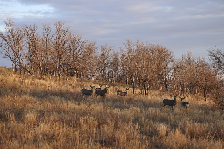

Watch the Wildlife
A small herd of mule deer meander through windswept hills, coveys of quail flush from the grass, and a plethora of birds, including waterfowl, barred owls and pileated woodpeckers, can be seen across the property.
View the Canadian River
The Canadian River cuts through one corner of the WMA. Fun fact: People in the area are unsure how the river (and the nearby town) got its name. Some attribute the name to French explorers, who may have thought the river, which does flow northeast for a time, was on a path to Canada. More likely, the name derives from the Spanish word for glen, cañada.