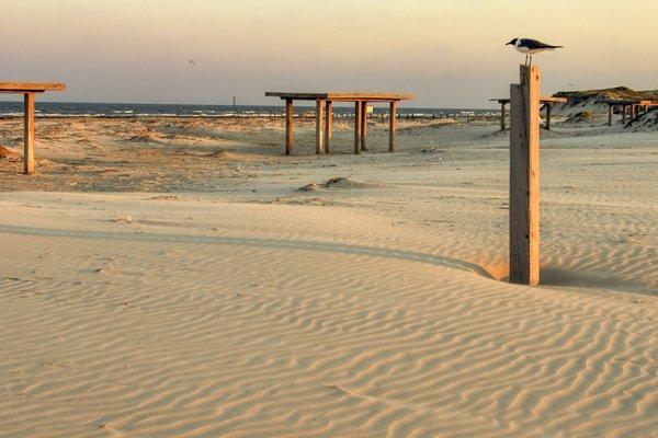
When the wind kicks up, the grasses blow like horsetails, and the sands gently reshape the dunes of Mustang Island State Park. The sun is bright, and I am strolling alongside South Texas Master Naturalist Randy Bissell, a professional geoscientist working to expand geological interpretation in the state parks. Our plan is to spend the day exploring various landforms around Mustang Island to study how river deposits, tidal action and sea levels all came together to give shape to this beloved spot.
“There are parks like Palo Duro, Enchanted Rock and Garner, where you can't miss their geology. It just kind of bursts out right in front of you,” says Bissell. “But at a place like Mustang Island, it's more subtle, and the geological processes are harder to think about.”
Most people are drawn to Mustang Island and the state parks of the Coastal Bend for recreation and wildlife watching. Shorebirds and seasonal migratory visitors share space with rare and endangered species such as the Aplomado falcon. Anglers and surfers enjoy their respective hobbies along the jetties at Fish Pass. During our tour, Bissell stops to chat with a couple collecting seashells. “It's all about making connections,” he beams afterward.
Texas does have parks that offer geology programs, many focused on impressive sights, big boulders and deep, colorful canyons. Others explore fossils and archeological remains hidden among the rocks. But because it lacks dramatic uplifts or surprising sinkholes, the Coastal Bend has tended to be a flyover for Lone Star geology enthusiasts. Until now.
Based in Corpus Christi, Bissell has been interested in geology for decades. Having enjoyed a long career, today he is working closely with the Texas Parks and Wildlife Department to spread the word about the interplay between geology and ecology across the Coastal Bend and South Texas. TPWD staff acknowledges this has been a missing interpretative component. These parks don't have the pulse-quickening cliffs and rocky outcroppings like those found in the Hill Country or along the Panhandle's Caprock, and so visitors tend to overlook basic topography and factors in the formation of barrier islands.

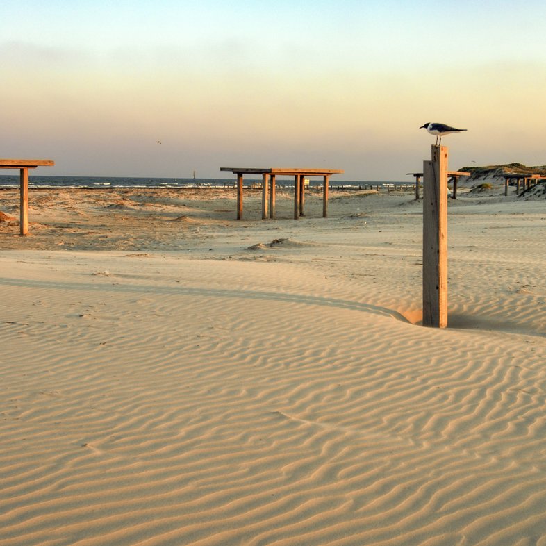
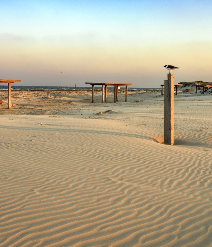
Dunes contain pockets of water and life.
Wade Grassedonio
Dunes contain pockets of water and life.
Wade Grassedonio
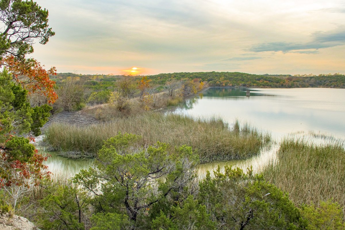
Mustang Island Park Superintendent Scott Taylor calls the dunes “the unsung heroes” of the big barrier island. Named for long-gone herds of wild horses that followed the arrival of French and Spanish sailors centuries ago, Mustang Island itself extends 18 miles beyond the park boundaries, bookended by Packery Channel to the south and Port Aransas to the north. The dunes not only create a buffer against major storms and rising seas that help protect human development, but they also shelter the island's grassy plains that sustain assorted wildlife.
“To a lot of people, our dunes just look like big piles of sand,” says Taylor. “But it's vitally important for visitors to understand these elements.”
Understanding the forces behind geological processes offers an invaluable window into both prehistoric times and human history, reflecting the influences that continental drift and natural disasters have had over broad territories often perceived as immovable. Benefits include predicting how plants and animals might behave given changes in the land, including the impact of human development.
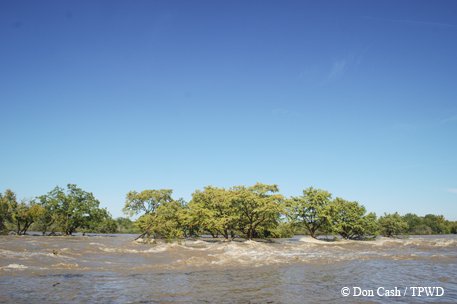
Texas has seven barrier islands that form a buffer between the Gulf and the mainland, including Padre Island, the longest barrier island in the world. Mustang Island faces the Gulf just north of Padre. It is backed by Corpus Christi Bay, home to the fifth largest port in the United States - making this saltwater estuary an economic as well as ecological resource.
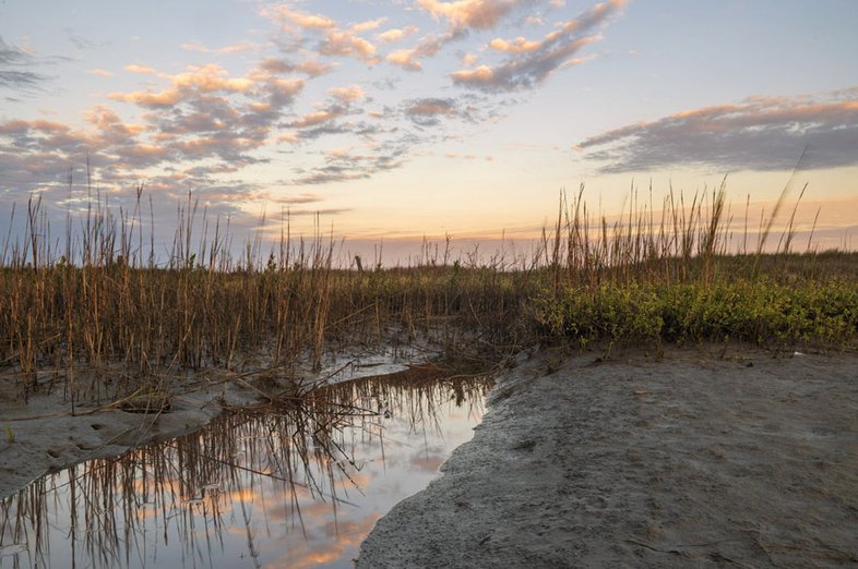
When he presents park programs such as “Secret of the Sands,” Bissell explains that the substrate of Mustang Island was the result of sediment deposited by the Nueces River around 18,000 years ago — before humans had arrived in the region. At the time, sea levels were much lower than today, and as the last Ice Age came to a close, wind and wave action pushed these deposits shoreward. Eventually, vegetation helped anchor the dunes, and around 2,500 years ago Mustang Island first came to resemble how the park looks today. “The ancient Nueces River trench is buried under the backside of this beach,” he says. “If we were to drill a core down 200 feet, we would find sand that is 8,000 to 9,000 years old.”
Wind and water shape the South Texas landscape.
Chase Fountain
Wind and water shape the South Texas landscape.
Chase Fountain
To hear Bissell describe it, when it comes to the interplay of geology and ecology, the park's protected 4,000 acres work in a sort of three-part harmony. The Gulf side features five miles of open beach and the front dunes topped by sea oats and other salt-tolerant plant life. Behind these dunes, which can reach 20 feet or more in elevation, the sandy interior grassland landscape hides pockets of freshwater that draw birds and sustain a wide variety of mammals, including native rodents such as pocket ground squirrels and grasshopper mice. Last, the expansive bay side north of Texas Highway 361 contains a mix of black mangroves, marshlands and tidal flats, providing a nursery for finfish, crabs and various invertebrates.
Ben Horstmann is the TPWD regional interpretive specialist for South Texas and sees potential in the continued development of tools to help visitors understand geology across the Coastal Bend. In addition to Mustang Island, Horstmann credits Bissell for jump-starting similar programs at Goose Island and Lake Corpus Christi, and offering proposals for the new Powderhorn Ranch State Park when it opens to the public in the coming years. These efforts will likely include “discovery trunks” laden with fossils, assorted rocks and archeological materials. Parks may post smartphone codes to help decipher the landscape.
“It's fascinating. I really never considered geology,” says Horstmann. “But if you lay a geologic map over all our ecoregions, you can really see how things are connected. It's like traveling through time, and as you delve into these layers you can see all the building blocks.”
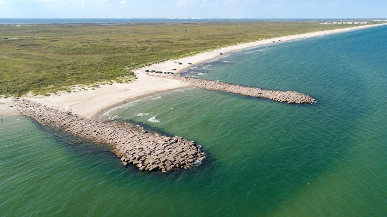

Fish Pass at Mustang Island.
Chase Fountain
Fish Pass at Mustang Island.
Chase Fountain
Back on the beach, Bissell considers the resort developments in the distance and the role of human activity in reshaping the island. He tells me how the early Spanish explorers failed to find a foothold on Mustang Island. Native tribes including the Karankawa used the landforms and vegetation on a seasonal basis to maintain a foothold on the coast for generations upon generations. He describes how the horses the Spanish and French left behind proliferated thanks to the freshwater lakes that persist in the grasslands. It occurs to me that geology offers lessons in sustainability if we pay attention.
“When we start telling the story of a place in Texas,” says Bissell, “it has a geological history. It has indigenous people's history, and a conquistador's history. It has a statehood history, and a national history. All of those histories tie back as characters in this Texas story.”