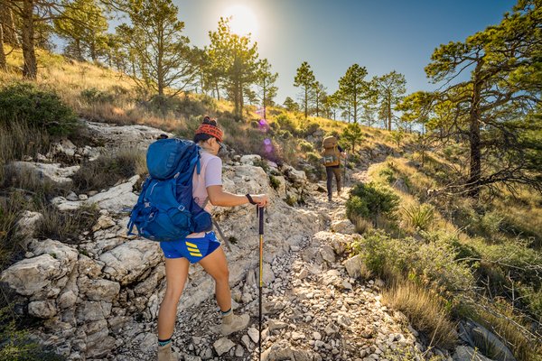
At some point in my life, day hiking started to feel like not enough. Instead of venturing into nature and then walking back out a few hours later, I wanted to feel as though I lived outside for a while, self-sufficient and free to explore without worrying about getting back to my car before dark.
And so, inspired by various backpacking writers (especially Carrot Quinn, whose blog and book Thru-Hiking Will Break Your Heart about her time on the Pacific Crest Trail filled my mind with backpacking dreams), I saved my money over a couple of years and invested in a good array of gear. I bought myself a nice down jacket, an ultralight tent and sleeping setup, and a beautiful green backpack.
With my ultralight gear — and my newly ultralight wallet — I began seeking out my first trip. In the summer of 2023, I booked an itinerary in the backcountry of Glacier National Park in Montana. In 2024, I took a three-hour flight and a seven-hour ferry to hike for a few days on Michigan’s Isle Royale. Later that year, I embarked on an ambitious trip to Alaska’s Brooks Range.
The year after that, I decided to do something different. Instead of planning a big trip, I wanted to stay in Texas. Texas is not widely hailed for its backpacking opportunities, but after some research, I realized that maybe it should be. While I suffered through a long, stressful lottery system to get less-than-ideal sites at Glacier, in Texas I was able to find stunning backcountry sites with plenty of permits available days before — or sites and routes that don’t require permits at all.


If you take a selfie at every trailhead on the LSHT, you'll have 15 selfies!
If you take a selfie at every trailhead on the LSHT, you'll have 15 selfies!
Over the fall, winter and spring of 2025-2026, our magazine photographer Maegan Lanham and I went on a Texas backpacking adventure. We scoured hiking blogs, park websites and crowdfunded spreadsheets for the best routes, and condensed our research into a list of trips of a variety of difficulties, from a one-night stay at an off-the-beaten-path state park, to a five-day adventure along Texas’ longest continuous hiking trail, to a breathtaking (in more ways than one) trek up Texas’ highest mountain — and then we hiked them all. Along the way, we found unexpected beauty, deepened our love for our gorgeous state and saw places we probably never would have experienced if we’d stuck to day hiking.
Hill Country State Natural Area
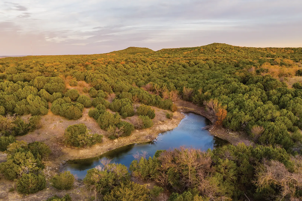
In backpacking language, a shakedown is a short practice hike where you test out all your gear ahead of doing a longer trail. As we embarked on our backpacking project, we decided to start with something short and sweet: a shakedown at Hill Country State Natural Area, just outside of Bandera. Hill Country SNA encompasses 5,000-plus acres of lovely country, with rolling juniper-covered hills, gentle grasslands and trails framed by spiky sotol.
On a December day threatening rain, we hiked in about three miles to the Wilderness Campground, which is situated in a bowl of juniper-covered hills. The rain came as we settled into camp, the sound of the drops pattering on the tent peacefully. When we woke up the next morning, it was so, so quiet. Not even a bug broke the silence. On the way back we made a detour up to the park’s highest point, West Peak Overlook, and looked out over the hilly terrain.
Hill Country has three backcountry camping areas: the Wilderness site, where we stayed, and the Hermit’s Shack and Butterfly Springs camping areas on the other side of the park. Only the Wilderness site is available to reserve on the park's website — if you’re interested in staying at Hermit’s Shack or Butterfly Springs, go ahead and book two (or more) nights at the Wilderness site, then call the office to switch one or two of them out for the other sites.
Shakedown completed, we were ready to get out on a longer adventure.


TPWD social media specialist Bianney Vasquez takes in the view at Hill Country SNA.
TPWD social media specialist Bianney Vasquez takes in the view at Hill Country SNA.
Lone Star Hiking Trail


Crossing a creek on the LSHT.
Crossing a creek on the LSHT.
We said we were ready for a longer adventure. What about … the longest hiking trail in Texas? Winding through the East Texas woods, the Lone Star Hiking Trail stretches 96 miles, and two months after our initial shakedown hike, Maegan and I hit the trail at Trailhead No. 1 (also called Richards) to hike some undecided amount of the trail. We carried enough food for a week — plenty of time for the ambitious hiker to complete the full trail — but chose to give ourselves grace when it came to our mileage.
Compared with other trails, the Lone Star is great for those who don’t enjoy planning down to the mile. On the parts of the trail within Sam Houston National Forest, you can camp anywhere along the route (as long as you’re 100 feet from the trail and not hiking during hunting season), offering supreme itinerary flexibility. There are also a couple of managed campgrounds, such as Double Lake and Stubblefield, and a few primitive sites and designated hunter camps which have some amenities such as posts to hang gear, clear areas for tents, etc.


The LSHT passes through 96 miles of East Texas forest.
The LSHT passes through 96 miles of East Texas forest.


The trail doesn't have much altitude, but it can still wear you out!
The trail doesn't have much altitude, but it can still wear you out!
Traversing the East Texas Pineywoods, the Lone Star is a meditation on the subtle differences between forests. We started on the western end of the trail, in tall, airy pine forest. After a few miles, the woods moved in closer, with undergrowth blocking out the light. At one point the ground became swampy and the bushy undergrowth gave way to palmettos. Sixteen miles in, we reached the shore of Lake Conroe (a welcome place to dip our tired feet), and the forest opened up again, sunlight streaming in.
Midway through our hike, we met several other thru-hikers from across the country and acquired trail names. I was Leaf, for my habit of spearing a stack of leaves on each trekking pole, and Maegan was Chafe, for reasons self-explanatory. We hopped off the Lone Star Hiking Trail after six days and 46 miles (we were taking our sweet time enjoying the forest), and by the end of the trip, Maegan and I were forever fans of both the trail and its caretaking organization, The Lone Star Hiking Trail Club. They have an excellent guidebook and many resources on their site, and it’s evident the amount of work and care they put into keeping the trail clear and safe for hikers.
Big Bend Ranch State Park


Influencer Irene Ogeto hikes in Big Bend Ranch.
Influencer Irene Ogeto hikes in Big Bend Ranch.
The largest state park in Texas, Big Bend Ranch is a backpacker’s dream (see our April 2026 story by Tyler Priest, who hiked a 100-mile loop in the park). With several consistently available water sources, gorgeous views and the darkest skies I’ve ever seen, Big Bend Ranch was top of our list for backpacking destinations.
So, in late February, Maegan and I drove out to the Sauceda Ranger Station. With some new friends tagging along, we’d chosen a one-night trip that would put us in proximity to Madrid Falls, a hidden waterfall deep in the park’s interior that flows after rain. The campsite, Chorro Vista, is technically a drive-up, but we wouldn’t recommend driving unless you have a serious four-wheel-drive vehicle. You don’t want to pay that $2,000 tow fee. Instead, you can hike approximately six miles in from the Puerto Chilicote Trailhead for a moderate hike through rugged desert terrain.


Chorro Vista campground offers panoramic views of the surrounding canyons.
Chorro Vista campground offers panoramic views of the surrounding canyons.


Big Bend offers the chance to see vast expanses of the Chihuahuan Desert.
Big Bend offers the chance to see vast expanses of the Chihuahuan Desert.
Chorro Vista was the most incredible campground I’ve ever stayed at. After setting up our tents, we climbed onto a high point and found dramatic 360-degree views of canyons cutting through the desert and layers of hills fading into the horizon. The next morning we attempted to hike to Madrid Falls, but our Gaia map led us astray. We did find a waterfall, a thin stream trickling over the edge of a cliff, and hiked over to its source. The stream was magical, with sculptural boulders sprinkled along its bed. Pools of spring water a few inches deep held tiny worlds within. Caught up in the romance of drinking from a trickling mountain stream, I filtered some into my Smartwater bottle. It tasted pretty bad. Still, it was water in the desert — can’t complain!
Standing on the edge of the cliff where the water trickled down, we could hear the rush of a larger stream and see the reflections of water bouncing off a stand of cottonwoods far below. That must be the real Madrid Falls, but we didn’t have time to hike down (which would require a round-about loop so as not to fall down any sheer rock faces). We’ll just have to come back.
Goodwater Loop


The view from the bottom of Crockett Gardens.
The view from the bottom of Crockett Gardens.
Tracing the shores of Lake Georgetown, the Goodwater Loop is a 26-mile trail through rolling Hill Country terrain. It’s not far from home for Austin-area hikers, and the quick and easy drive in familiar landscapes lured me into the sense that this trail would be a walk in the park. It turned out to be one of the more challenging hikes we did, likely because we did it in only two days.
Maegan and I set off in mid-March, just after rains had soaked the area, bringing out a profusion of wildflowers and leaving the trails very muddy. Just five miles in, the soles of our shoes were more mud than rubber, and we clomped along through oak-filled woodlands and grassy paths with heavy footfalls. “What are you training for?” asked a man we met along the path. “Nothing,” we replied. “Just hiking!”
You can hike this loop in either direction, and spread it over two or three (or more) days depending on your desired time out on the trail. There are several parks with excellent camping spread along the length. We chose to start at Cedar Breaks Park and hike counterclockwise (against the advice of Alltrails reviewers, who recommended the other way; we just didn’t want to finish our hike crossing a giant dam).
The soft spring grass and brightly colored leaves and flowers made for beautiful walking. At one point I ventured from the trail to investigate a whole refrigerator that had been swept, along with what looked to be a football field-sized patch of debris, into the mouth of the lake by recent floods. We camped midway at Tejas Park, where the shining San Gabriel River is still a river and not yet Lake Georgetown.
As we neared the end of the trail on the second day, Maegan and I had become separated walking at our own paces. Without my phone, which had died, or any other witnesses, I thought I might be hallucinating when I came to a sight like I have never seen in Texas. Emerging from a fragrant juniper forest, I heard running water and crossed a small footbridge into a patch of brilliant purple irises. Walking on, I was met with the baleful stare of a snow-white donkey. A little farther along, the water multiplied and gushed over a moss-covered hillside. It all felt surreal, like I had walked into a fantasy novel.
At this point, I realized where I was: Crockett Gardens! I’d seen photos of these springs (although from underneath it, not on top of it, where I currently was) from news stories when a large part of the moss- and fern-covered landform collapsed in December 2022. It was a magical part of the trip, and the cool spring water gave me energy for the last few miles of the hike. A couple of hours later we finally reached the car, exhausted, but amazed at what wonders lay within 30 minutes of home.
Guadalupe Mountains


TPWD social media specialist Jimmy Zuniga not only climbed the tallest peak in the state — he did it on TV!
TPWD social media specialist Jimmy Zuniga not only climbed the tallest peak in the state — he did it on TV!
For the final hike and crowning achievement of our backpacking project, we set out to trek to the top of the tallest mountain in Texas: Guadalupe Peak. I had learned a few years back about the backcountry site that lies about a mile from the summit, and loved the idea of camping there — almost at the top of Texas.
At basecamp (Pine Springs) the night before, our hiking group chatted about the upcoming challenge. Our coworkers from the Texas Parks & Wildlife TV show on PBS were joining us, and TPWD social media video specialist Jimmy Zuniga had kindly agreed to be the main character of their episode. We went through our packs together, discussing which items we could leave behind to save some weight.


Our hiking group for the Guadalupe Mountains trip poses for a trail selfie.
Our hiking group for the Guadalupe Mountains trip poses for a trail selfie.
Still, when we set off the next morning, our packs felt heavier than they had on any previous trips. There is no surface water available to filter on this hike, so we had to pack in as much water as we would need for two days. At the recommended gallon per day, that water ended up weighing more than 16 pounds.
Guadalupe Peak is a beautiful hike from start to finish. It’s just harder to appreciate the beauty during the first mile, which is pretty much completely made of stairs. With that painful section behind me, I started noticing the vibrant trunks of Texas madrone trees and marveling at the view, which got more dramatic with every switchback. It was hot at the base of the mountain, but by the time we straggled into camp after a grueling three miles and 2,000-plus feet of elevation change, it had cooled down considerably. We were welcomed by softly waving grass, campsites with panoramic views, and the inviting shade and mesmerizing bark patterns of alligator junipers.
The next morning we woke before sunrise to head to the peak. If it was cool at our airy campground, it was cold up here. Wind whipped our hair as we exited the last wooded section and found ourselves out in the open on the mountain’s face. With the rising sun behind us, we could see Guadalupe Peak’s giant shadow cast on the desert plains below. We finally scrambled up the last few feet to the summit, and took in the view from the top of Texas, which rivals any I’ve seen in Alaska, Michigan or Montana. This year, I’m glad I stayed home.


Eva and Maegan stand at the Top of Texas.
Eva and Maegan stand at the Top of Texas.