The noon sun hits me from directly overhead, and I can feel beads of sweat form on my temples.
I’m covered in mud and bug bites, but there’s a scent of honeysuckle and rain in the air, distracting me from a nagging soreness in my knees and shoulders after lugging a 30-pound pack for four days. A muddy, tired dog that has adopted me follows faithfully behind.
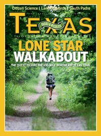
I’m reviving the lost practice of foot travel, connecting the dots of isolated small towns and learning the effort needed to make long journeys through my own physical ability. In preparation, I’ve read John Graves’ classic Goodbye to a River. I’m walking the Northeast Texas Trail, and, if all goes according to plan, I’ll be the first to hike the entire 130 miles on foot.
The Northeast Texas Trail (NETT) rail-to-trail conversion project has been in the works since the 1990s, with various groups working on different legs of the trail. Union Pacific Railroad owns the trail land from Paris eastward to New Boston; the Santa Fe Railroad used the tracks in the western portion. The unused rail corridor was given to the trail development groups to prevent landowners from sectioning it off in case the railroad companies decide to return.
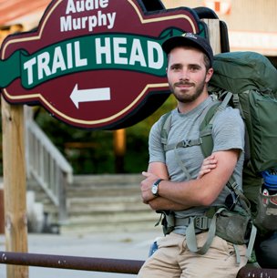
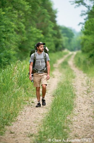
The author at the Farmersville trailhead of the Northeast Texas Trail.
Chase A. Fountain
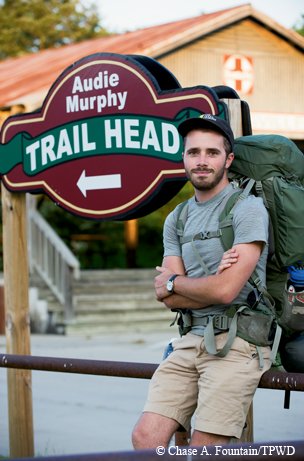
The author at the Farmersville trailhead of the Northeast Texas Trail.
Chase A. Fountain
Some cities, like Farmersville, Paris and New Boston, have taken advantage of this already-cleared corridor and tied it into existing park areas to encourage recreation and ecotourism. Other towns, as I’d find out along my journey, weren’t so enthusiastic about a trail bringing bike, foot and horse traffic to their area and have let their section of trail become overgrown and mostly impassable.
I start my journey late in the day on May 14 in Farmersville, an hour north of Dallas. Here, the trail begins by Onion Shed Park and is paved and lined with streetlamps. Distances are marked every quarter-mile.
But indications appear quickly of how drastically the form and condition of the NETT vary. After the first mile, the lights disappear. Shortly after that, the distance markers stop, and around the third mile, the trail is no longer paved. I reach this point just as the sun sets but continue on, following the light of my headlamp. Before the sun dips completely beyond the horizon, the dense, albeit thin, lining of trees along the trail creates the illusion that I am walking through a thick forest. Being from the city and not knowing the validity of rumors I had heard of panthers in the area, I grip tightly in one hand the machete I had bought earlier that day. In the other hand I hold a fallen tree branch that makes for a crude but effective walking stick.
Walking alone in the dark of a forested trail is a good time to reflect on my motivation for making a 130-mile journey on foot by myself. In a way, I was searching for an element of freedom that I had recently felt fleeting from my life. In the summer of 2012, after spending several months working on farms in rural France, I embarked on a weeklong trek down Spain’s Camino de Santiago de Compostela. That journey took me over the Pyrenees and across Basque country, in the company of pilgrims from all over the world.
Walking at my own pace and sleeping wherever I pleased in the ever-changing scenery, living off chorizo sandwiches and meeting interesting travelers from across the world — this was a life I wanted to live forever. But reality hit after I returned to Texas and started working 9-to-5 again. Looming ahead was a commitment to an intensive two-year graduate school program. So in setting off on this long hike, I was looking to regain some of the wonder and freedom of being a young man traversing the world on his own terms, perhaps for the last time in my foreseeable future.
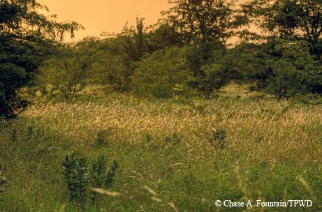

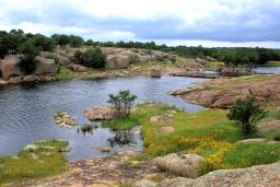
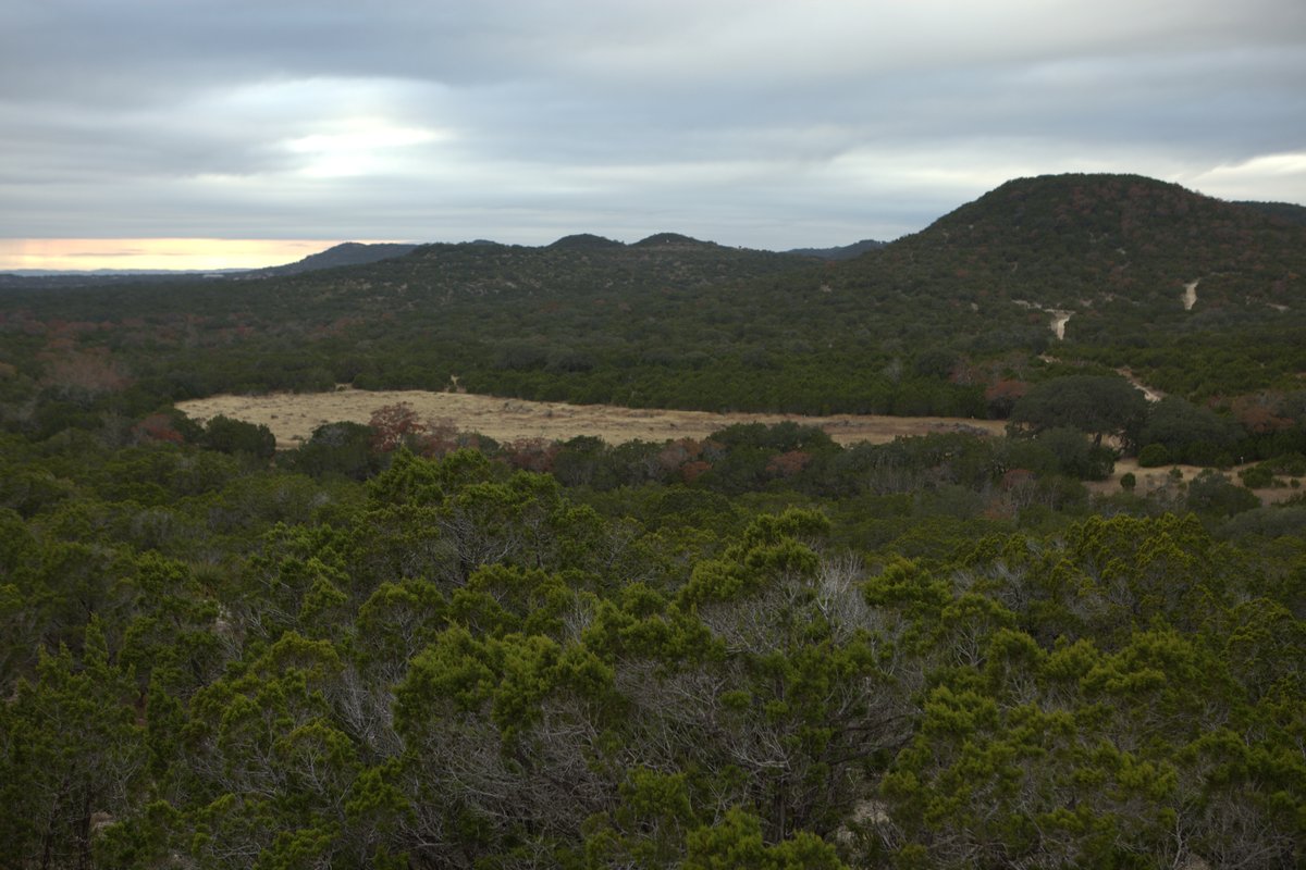
The trail runs through part of the Caddo National Grasslands.
Chase A. Fountain
The trail runs through part of the Caddo National Grasslands.
Chase A. Fountain
The first day I cover six miles, camping near a cemetery just inside the town limits of Merit. On the second day, I intend to make it to Ladonia, covering a 24-mile segment that might prove to be an overly ambitious undertaking. By the time I enter the Caddo National Grasslands, I am wet with rain and my pack weighs heavy on my shoulders.
I consider bedding down on the trail. There’s a lot of tree cover that might offer a little respite from a storm that’s clearly forming overhead. But I’m determined to stay on schedule, no matter what. Motivated by the desire for a cold beer to ease my tired body into sleep, I press onward.
With sore knees, wet feet and the beginnings of blisters on my soles, I follow the trail into town, where I’m planning to camp. Storm clouds continue to form overhead, and I’m eager to set up camp for the night. Just as I begin unpacking my tent, a man from a nearby house walks over. I assume he’s going to chase me off, but to my surprise he greets me cheerfully and asks if I’m hiking the rail-trail.
The man introduces himself as Harold, and explains that he works for the city and knows all about the trail. He tells me there’s a store open until 8, and an old rodeo arena just past it where I’ll find better shelter for my tent. Harold goes back to his house to get me a better walking stick, and returns with his son, who seems surprised that someone would willingly walk 130 miles.
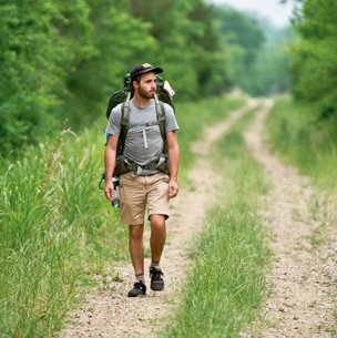
Day 2 of the hike.
Chase A. Fountain
Day 2 of the hike.
Chase A. Fountain
As I approach the rodeo area, Harold and his son pull up in their truck. Harold had called the mayor, who, either out of genuine concern for my safety or worry that a dead hiker would be bad for her town, instructed Harold to find me and take me to Rick Barrett, another city employee, who kindly lets trail cyclists stay in a cabin on his property.
Barrett is out, but by phone he tells me I am welcome, and to help myself to the beer in the mini-fridge. At last, I drink my long-awaited beer with Harold and his son.
The dog shows up while I’m making dinner. I’m sitting on the covered porch, heating up beans on my Jetboil stove, when a brown dog of undetermined breeding pops out of the rain. Assuming it’s Barrett’s dog, I shove him away from my dinner and tell him to go back to the main house.
I awake the next day to find it still raining. Half upset for the setback and half glad I can rest my legs a little longer, I slowly pack up and wait for the storm to quit. Around 8, I set out, hoping I might at least make it five miles to Pecan Gap, but I get only as far as the store on the other side of town before it starts raining again.
I continue to hide from the storm until lunch, when I walk to Gloria’s Kitchen, a local restaurant. On my way, the dog appears again and begins to follow me. Harold shows up at the restaurant, and I ask him about the dog. He says people sometimes abandon dogs around there, but that this one looks attached to me and will probably make a good trail companion.
Giving up on walking anywhere that day, I head back to the cabin with the dog and read on the porch. Before going to sleep, I tell the dog that if he wants to go with me, I’ll be setting out around 6. Sure enough, he appears on cue as I make coffee and follows me off onto the next leg of my journey.
Anyone familiar with the history of small American towns can tell you the same story. How the ones lucky enough to have the railroad run right through their town experienced prosperity, only to later lose out when the highways bypassed them. A walk on the Northeast Texas Trail is a history lesson that underlines this point. Celeste, Ladonia, Pecan Gap — all these little towns, though populated by kind souls and hard workers, bear the scars of economic hardships.
One of the main selling points for allowing the trail to run through a town, and for maintaining it, is the economic benefit it brings for places that otherwise don’t offer much for tourists. With 130 miles being too far to carry a week’s worth of provisions, it is perfect that, with few exceptions, the towns I traverse on the NETT have grocery and convenience stores, cafés and restaurants. I like to imagine each of my little pit stops for beef jerky, cans of beans and the occasional diner meal along my journey as demonstrations, albeit small ones, of the potential flow of tourist dollars across the region. A few cyclists have posted on the Internet about making “credit card rides,” meaning all they carried along the trail were credit cards, staying in hotels and eating at restaurants along the way. I am more frugal, camping in public parks and eating mostly what I buy at grocery stores.
When I take breaks in the towns, locals often ask about what I’m doing. Some even offer me a hot meal. But as long as the weather’s clear, I prefer to drop my pack and rest out in the middle of nowhere. I sprawl out on the grass, and the dog lies down next to me, panting heavily. I feel connected to travelers who might have crossed this way before by foot, early settlers or even Caddo Indians out hunting.
After my rainy sojourn in Ladonia, I am well rested, and my new companion follows close behind on a good, clean stretch of trail. In the cool air after the storm, walking is easy. Crimson cardinals dart across the trail, and the dog chases after the occasional rabbit, only to reappear empty-jawed out of the brush a few yards down the trail. Sometimes we spot other creatures, like an armadillo rooting around in the grass for grubs.
I’ll confess here that I will not become the first person to walk the entire Northeast Texas Trail. We make it six miles to Pecan Gap in an easy two hours. But, as soon as the trail meets FM 904, it disappears into a mess of brush, tall grass and trees. To make up for lost time and to avoid spending the day walking on a paved road, I catch a ride with a state transportation worker named Larry to the town of Roxton, where I pick the trail up again.
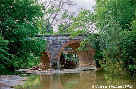

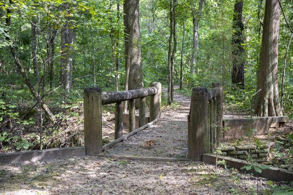
An old railroad bridge near Roxton.
Chase A. Fountain
An old railroad bridge near Roxton.
Chase A. Fountain
Roxton has maintained the trail well. There’s a restroom beside it and several shops nearby selling provisions, but five miles outside of town a landowner has set up a gate across the trail. The gate is easily scaled, but the overgrown grass is swampy. Heeding a warning about snakes, I opt to take the muddy country road around. After going several miles out of our way, we cross the trail again. It’s open here, but still very overgrown. I bushwhack for a few hundred feet, but it becomes too difficult to determine which way to go. So I backtrack and again follow the country road a few miles to the main farm-to-market road, and flag down another ride.
The driver who picks me up turns out to be James Cooper, mayor of Roxton. While giving me a ride to Paris, he says he had seen me walking through town earlier and was curious how far I could get on the trail. The residents of Roxton are enthusiastic about the trail, he explains, and the city has invested a lot in it. He shares my disappointment that some landowners are not as enthusiastic about the project.
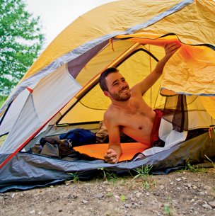
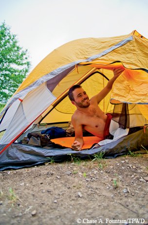
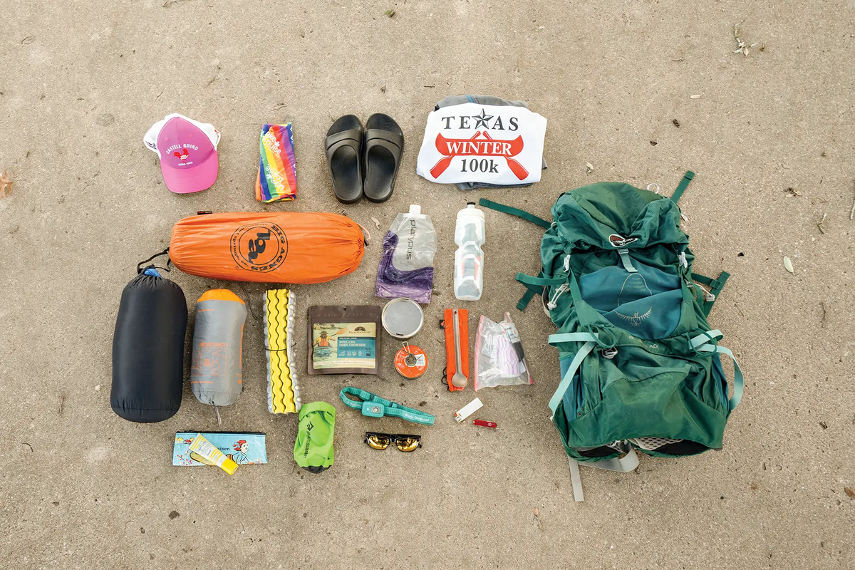
Camping out along the Northeast Texas Trail.
Chase A. Fountain
Camping out along the Northeast Texas Trail.
Chase A. Fountain
I camp in Paris, and Earl Erickson meets me early the next morning. Erickson is the chair of the steering committee for the Trail de Paris bike ride and has been instrumental in writing grant applications and promoting the trail. We’d been in contact during my trip planning, and he’d even sent over his son, a doctor, the night before our meeting, with supplies for me to drain my blisters.
Erickson and I walk together to where the NETT meets a series of nature trails that wind through an old-growth forest to the east of Paris and connect the main trail to the large Paris Sports Complex. Erickson is confident that soon they’ll persuade the landowners and reluctant town officials to take down their fences, maintain their sections of the corridor and connect the entire trail.
From Paris, through Reno and to Blossom, around 10 miles, the trail is easy, mostly paved and totally clear. I had been warned that the trail becomes difficult after Blossom, but I’m still hopeful I can manage it. Trouble arises quickly, however, behind a Shell station in Blossom, where the path disappears into thick woods.
Here I accept my last ride, from a kind schoolteacher on her way to Avery to see her grandchildren. From Avery to New Boston the trail is just as easy as the beginning in Farmersville. I hike another seven miles that afternoon and camp on a baseball field in De Kalb, just 12 miles from the New Boston trailhead.
The act of rail-to-trail conversion is significant for reasons other than the recreation and tourism that it allows. One of the initial promises of the railroad, and by extension industry in general, was safe and quick passage through the wilderness. Personal journeys on foot were replaced with blurred views of trees and hills in speeding vistas. Now the trail has returned to nature, and travel is done at a more deliberate pace. Walking is nowhere near as fast, but the journey is more than just getting somewhere fast. It’s an exploration, both of the land and the self.
When I reach the trailhead in New Boston where I’d left my car, there’s no finishing line tape to break through, no rain of confetti, not a single soul to congratulate me on having walked (most of) a 130-mile trail in six days. It’s late in the afternoon, and the stagnant air holds the heat and humidity like a sauna. The dog, still following faithfully, finds a place in the shade and watches as I pack the car. For a dog that has willingly followed me for the last hundred miles down overgrown trails and into strangers’ truckbeds, he takes a surprising amount of coaxing to jump into my car.
OK, so I wasn’t the first to walk the entire Northeast Texas Trail. But driving back down U.S. Highway 82, which for a while runs almost beside the trail, I know I’ve momentarily lived at peace in the wild, taking away new lessons and new connections.
Someday, perhaps, I’ll be able to return to finish what I’ve begun.