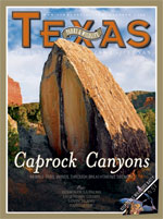
Doodlebug Way
The Caprock Canyons Trailway follows an old rail line as it transports you to another time.
By E. Dan Klepper
Along the abandoned Fort Worth and Denver South Plains Railway Line, beyond the town of Estelline and a few miles shy of Parnell Station, the remnant trackway enters a stand of windrow trees.
The overhanging tree branches form a tunnel of sorts, shading the hot Panhandle landscape with a melancholoy twilights. The gloaming lulls the senses and fodders the imagination, making it easy to roll back the years when the railway line operated the local Doodlebug Passenger Service. The lazy click-clack of the Doodlebugs, small train cars that ran between Estelline and big city Lubbock during the 1930s, echoes here beneath the droopy boughs. Cottonseeds twinkle in the breeze. Puffs of whirligigs glitter against the slant sunlight. Bees buzz and big dumb dogs bark nonsense at the ginnery nearby. A local farmboy, barefoot and carefree, lolls next to the trackway then flags a Doodlebug down. He hops on board, rides the "Doodle" 10 miles or so then hops off, fishes in the creek, lolls a bit more, flags again, hops on, then rides back home.
Inspiration for this heady kind of nostalgia still permeates the countryside along the Fort Worth and Denver South Plains Railway Line, although the line's wooden ties, rails, steam engines and Doodlebugs are long gone. But the railroad berm it was built upon still survives, and its ghost tracks have since been resurrected as a 64-mile multi-use hiking, biking and equestrian trail called the Caprock Canyons Trailway. The trailway traverses the Panhandle's red dirt cotton fields across 55 trestle bridges, through one tunnel and into the canyons, then climbs up and over the caprock escarpment to the plains above on a 7 percent grade.
The Fort Worth and Denver South Plains Railway Line was once the purview of the larger Burlington Northern Railroad, and its detour through the Panhandle's southern plains enabled local producers to send their products all the way to Colorado and beyond. The line was completed in 1928 and served the Texas High Plains for more than 60 years. Its construction required more than 30,000 workers, mule teams, dynamite, and a track-laying machine that could lay a mile of track (including 2,880 ties and 320 sections of rail) in 2 hours and 30 minutes. Steam was the locomotion of choice, so nine 50,000-gallon steel water tanks were installed along the route. Burlington closed the line in 1989, and three years later it was purchased, modified and spruced up by the Rails-to-Trails Conservancy. Once the makeover was completed, the trailway was turned over to the state park system with Caprock Canyons State Park in charge and today it accommodates trekkers on foot, mountain bike and horseback.
The trailway is divided into six individual trails varying in lengths from 5 to 17 miles each. Its eight trailheads can be accessed via farm-to-market roads and state highways, allowing trekkers to complete the trailway piecemeal or traverse it all in one trip by caching water and supplies at strategic trailhead locations.
On either end of the 64-mile trailway, trekkers will find the tiny towns of Estelline and South Plains. Between them, the trailway passes through the rural towns of Turkey and Quitaque (pronounced kit-a-kway). The section from Estelline to Turkey, totaling 32 miles, is only minimally maintained, thus providing trekkers with a more challenging experience. Bushwhackers who don't mind sunflowers that often tower above the head will enjoy it.
Funding for additional maintenance on this section is in the works, however, says Walt Dabney, State Parks Division Director. "Currently, we are trying to use trail grant funding and match it with some park maintenance funding," he says.
The remaining section from Turkey to South Plains, another 32 miles, sees more visitations and a higher degree of maintenance; therefore it may hold greater appeal to day trekkers. The fact that the entire trail system is built on the old railroad berm makes the trailway's 64 miles flat and wide, its grades moderate, and most of its segments easy to negotiate. Primitive camping is allowed along the trail although permanent outhouses are located near most of the trailheads. Trekkers must carry all of their water.
Estelline Terminal is the easternmost trailhead for the trailway and also the start of the 10-mile Plains Junction Trail. The trail is a relatively straightforward route through cotton and peanut country, and the remnants of this once-lucrative agricultural economy are in evidence. Abandoned farmhouses sit along the horizon beneath mottes of shade trees, testaments to more productive times. Many of the farms continue to produce crops, giving trekkers a "behind-the-scenes" view of farming operations. Most farmers are friendly, but some occasionally use the trailway as a farm truck route into and out of their fields.
The Plains Junction Trail ends at Parnell Station trailhead, where the trailway continues on the 12-mile Grundy Canyon Trail. The small bridges along the route provide a bird's eye view of the area's 250 million-year-old Permian geology. The region served as the edge of an ancient inland sea once occupied by Dimetrodon and Cotylorhynchus, two dinosaur types that would have made lousy trekking partners. The view of the red sandstone layering is courtesy of thousands of years of erosion, as water etched gullies into the landscape on its way towards the Red River. The color, a rich brick red, is a bright complement to the viridian plant life that takes root beyond the farmer's plow.
Grundy Canyon Trail ends at Tampico Siding trailhead, where the Oxbow Trail begins. Oxbow Trail is a 10-mile pastoral stroll through cotton and peanut fields with an occasional crossing of a wooden gully bridge to disrupt the seemingly arrow-straight route. Small islands of wild vegetation float occasionally by in an endless red ocean of plowed fields, suggesting remnant bits of flotsam from the once vast prairie. A glance from horizon to horizon makes it easy to imagine the countryside covered in bison, as it was 150 years ago. Birds, bees, lizards and toads populate the trailside, but so do feral hogs, the scourge of both landowners and environmentalists. Farmers have drastically reduced their peanut crop simply because the feral hogs invade the fields and consume all the peanuts before harvest time.
The real charm of Oxbow Trail is that it leads trekkers to the tiny town of Turkey. Established in the early 1890s, Turkey was first called Turkey Roost due to the American turkeys that can be found roosting along nearby Turkey Creek. It was shortened later to plain ol' Turkey and had its first newspaper, called the Turkey Gobbler, by 1919. Like most prairie farming communities, Turkey suffered its ups and downs throughout the first half of the 20th century, growing and shrinking accordingly until it settled into a comfortable rural community with a few good mom-and-pop restaurants, a very pleasant hotel, a volunteer fire department, a school, five churches and a few hundred residents. Trekkers tackling the entire 64-mile trailway over the course of several days have the opportunity to skip a night of primitive camping and book a room (and a hot shower) at the Hotel Turkey.
The 10-mile Kent Creek Trail takes up the trailway where the Oxbow Trail ends, leaving Turkey at the Turkey Depot trailhead before crossing historic ranching country. Cattleman Charles Goodnight, with the financial backing of British businessman John Adair, established the JA Ranch in 1877, a 1,325,000-acre cattle spread that once dominated the horizon view along Kent Creek Trail. The ranch, home to more than 100,000 head of cattle, succumbed to division in later years, but the stretch of horizon, unbroken by anything modern, remains.
Segments of Kent Creek Trail offer havens for both trekkers and wildlife in the form of shady rows of trees, called shelterbelts, which were planted years ago by farmers to reduce wind-driven erosion. Inadvertently, farmers provided ideal conditions for woodland-loving birds that typically prefer protected edges along an open field or prairie. Birders should keep an eye out for blue grosbeak, bobwhite quail and the beautiful scissor-tailed flycatcher.
Kent Creek Trail ends in the small town of Quitaque. New Mexican trader José Piedad Tafoya established a trading post here in 1865, trading goods and ammo to the Comanche for stolen livestock. The settlement was called Quitaque by cattleman Charles Goodnight, who believed it meant "end of the trail." According to some sources the actual meaning of the Indian word is "a pile of horse manure," and a third story suggests it was named after the Quitaca Indians, a designation that was understood by the Anglo settlers to mean "whatever one steals."
Kent Creek Trail becomes Los Lingos Trail as it leaves Quitaque at the Quitaque Depot and the Quitaque East trailheads before traveling 5 miles to Monk's Crossing. The trail offers trekkers a chance to cross the longest railroad bridge on the Caprock Canyons Trailway, a concrete trestle that spans the width of Los Lingos Creek. The bridge, built with the help of a pile driver, is a favorite nesting spot for cliff swallows. During the spring and summer months hundreds of the birds can be seen diving in and out from the bridge's underbelly.
The Comanche passed through the region frequently in the 1800s along with New Mexican traders, called Comancheros, whose primary trade customers were the Comanche. Comancheros provided guns, whiskey, and stolen cattle and the Comanche provided captives for the slave trade. Hundreds of victims were forced to cross El Valle de Las Lágrimas, or the Valley of Tears, a wide, shallow valley that can be seen just north of the trail.
Los Lingos Trail ends at the Monks Crossing trailhead. Here, the Quitaque Canyon Trail begins, providing the final east-to-west link in the Caprock Canyons Trailway. Its 17 miles of easy trekking follows a slowly rising 7 percent grade and leads trekkers from the Red River Valley to the top of the Caprock Escarpment. The hike is a scenic tour through the Permian Age, and, thanks to the railroad's need for a steady grade to accommodate freight train physics, trekkers can examine the geology of layering in the many crosscuts made by the railroad building crews. The trail ends atop the caprock, literally a cap of rock that covers the red sandstones and siltstones of the Quartermaster formation.
One of the highlights of the Quitaque Canyon Trail is Clarity Tunnel, a fine example of railroad engineering from the early 20th century. Once railroad building crews reached the rock that forms the Caprock Escarpment they had a real challenge on their hands. The rock is unstable and soft in certain places, thus requiring reinforced tunnels. Open crosscuts wouldn't always work here, as the walls of crosscuts tended to erode and cave too easily. Two tunnels were constructed in the more unstable sections – the Clarity Tunnel, originally 790 feet long, and a second, shorter tunnel called Gowdy Tunnel. In 1968 the Gowdy Tunnel collapsed due to a train derailment. Engineers were required to "daylight" it, meaning they blew it open with dynamite, and it was never replaced. The Clarity also collapsed five years later after a derailment, but, rather than daylight it, engineers simply moved enormous amounts of dirt in order to free the rail cars. The incident shortened the tunnel by 208 feet, leaving it at its present 582 feet.
Void of train traffic today, the tunnel interior makes a perfect roost for Mexican free-tailed bats. Once trekkers pass through the tunnel cautiously and quietly in order to avoid disturbing the bat colony, they may want to set up camp around the benches and outhouse that are used for bat flight interpretation programs at the western entrance.
"A few weeks ago I was at the tunnel to witness the bat flight, and it was the most spectacular flight I have ever seen," says Deanna Oberheu, park superintendent for Caprock Canyons State Park and Trailway. "The flight started early, while the sun was still lingering in the sky, and the bats were fully visible. We were able to watch a pair of prairie falcons hunting the bats. Then, after the sun went down and the falcons retired, a great-horned owl began hunting bats!" Oberheu and staff conduct bat tours on Friday and Saturday nights from June through August, by reservation only. Visitors are transported to and from the tunnel via the trailway.
Beyond Clarity Tunnel, small wetlands populate the landscape below the trail berm and along the final leg of the Quitaque Canyon Trail. During wildflower season the big, beautiful Texas basketflower often lines the trailway. Trekkers pass through more crosscuts of the distinct caprock just before the trail delivers them on top, where a broad plain stutters endlessly with tidy plowed fields of cotton and peanut crops. The tiny town of South Plains wavers in the heat, the sun glancing off its shiny cotton gin and its black water tower squatting like a tin can of oil in the distance. The Panhandle Plains, remarkably unchanged for almost a century, unravels in a straight line all the way to the horizon. This vision is a bit of the magic that awaits trekkers along the Caprock Canyons Trailway, a route that tracks the landscapes and memories of the Panhandle past. As the trailway rises out of the canyonlands and crosses the unflinching flatness topside, the sentiments of a handwritten entry in a 1954 Turkey High School yearbook come to mind, summing up the wistful romance inherent in all meager, pancake prairie towns and the lofty aspirations of their big Panhandle dreams:
"When you live on a Hill,
Send me a Kiss,
Whippoorwill."
Details:
- The trailway is administered by Caprock Canyons State Park. Information and permits can be obtained at the state park's Visitor Center and Headquarters, located on FM 1065, 3.5 miles north of the State Highway 86 intersection in Quitaque; (806-455-1492; www.tpwd.state.tx.us/caprock canyons). Trekkers are required to check in at the state park headquarters before using the trailway.
- Plains Junction Trail is approximately 45 miles east of Quitaque, off Highway 287 just north of Estelline and the intersection of Highway 86 at the Estelline Terminal trailhead. It can also be accessed from the Parnell Station trailhead just off State Highway 86.
- Grundy Canyon Trail can be accessed either from Parnell Station or the Tampico Siding trailhead on FM 657.
- Oxbow Trail can be accessed either from Tampico Siding or the Turkey Depot trailhead in the town of Turkey.
- Kent Creek Trail can be accessed either from Turkey Depot in the town of Turkey or Quitaque Depot or Quitaque East trailheads in Quitaque.
- Los Lingos Trail can be accessed either from Quitaque Depot or Quitaque East in Quitaque or Monk's Crossing trailhead off FM 689.
- Quitaque Canyon Trail can be accessed either from Monk's Crossing or from South Plains Terminal trailhead on Highway 207.
- Reservations for Hotel Turkey Bed and Breakfast (806-423-1151).
- Shuttle service for vehicles can be arranged for a fee through the Caprock Home Center in Quitaque (806-455-1193, www.quitaque.org).