THE MORE I GET into adventuring on my bike, the more I enjoy the simplicity and safety of off-road trail riding that is car-free. When I visit other states, I often look for long-distance trailways that allow me to effortlessly travel via bicycle. I have ridden across New York, Pennsylvania, Maryland and Wisconsin, and most of the off-road miles I have ridden in those states were on old railroads converted to trailways. Rail-trails, to me, are some of the most rewarding trails in the world to ride on.
I wanted to find what rail-trails existed in Texas, so I loaded up my bike to explore two options connected to state parks.
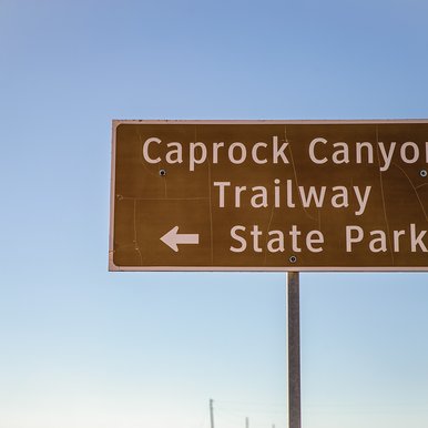
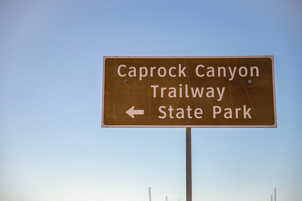
The Texas State Parks system has two trailways converted from railways — the Caprock Canyons Trailway, which offers 64 miles to off-road cyclists, hikers and horseback riders in the scenic canyon country along the Caprock Escarpment, and the Lake Mineral Wells Trailway, which stretches 20 miles across the North Texas countryside.
These two trails exist thanks to a nonprofit organization that gives old, abandoned railways a second life — the Rails-to-Trails Conservancy. The conservancy is a national organization that strives to build a nation connected by trails and works to reimagine public spaces and create safe ways for everyone to walk, bike and be active outdoors. Most of all, the Rails-to-Trails Conservancy believes trails have the power to transform communities and create joyful, vibrant public spaces that are equitable and inclusive.
Texas is near the back of the train on rails-to-trails conversions. In 2020, Texas ranked first in the U.S. in railroad mileage, with more than 10,000 miles. About 6,000 miles of railroad have been abandoned in Texas for various reasons, and of those 6,000 abandoned miles, only 344 have been converted to trailways.
Projects such as the Northeast Texas Trail (which I documented riding for Texas Parks & Wildlife magazine in June 2021) and the Lower Rio Grande Valley's Caracara Trails are being developed to give future Texans an opportunity to utilize bike/pedestrian/horse trails — some paved and some unpaved — in safe spaces away from traffic along old railways.
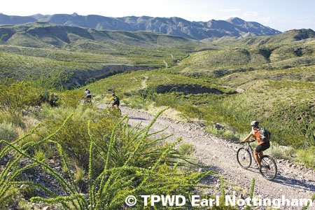
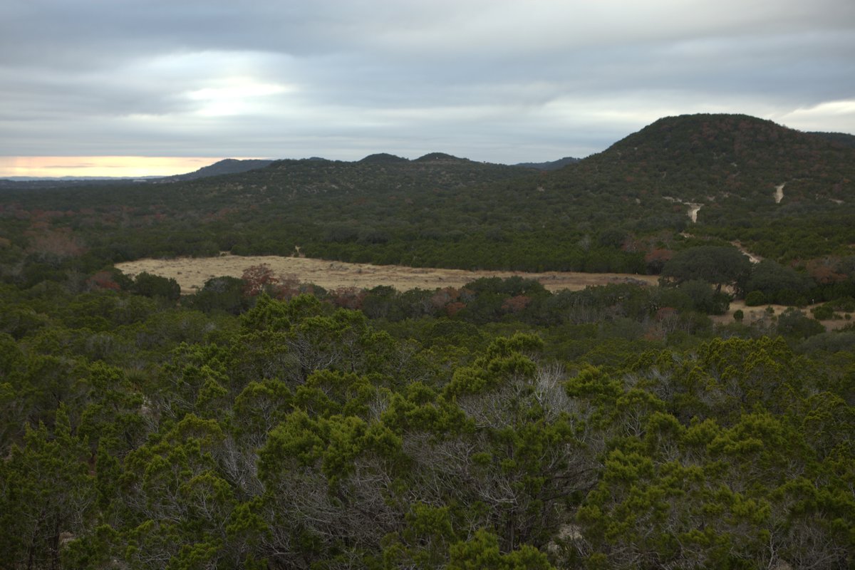
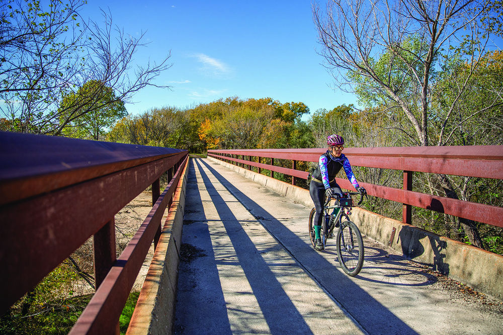
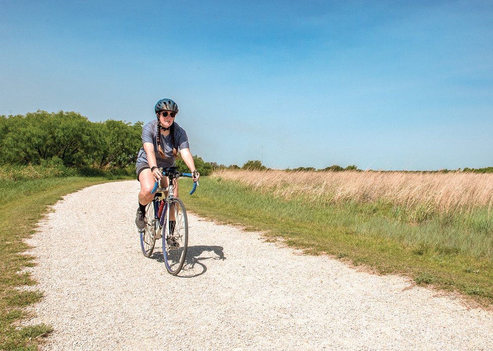
The Caprock Canyons Trailway crosses rural areas along an old rail line.
The Caprock Canyons Trailway crosses rural areas along an old rail line.
Caprock Canyons
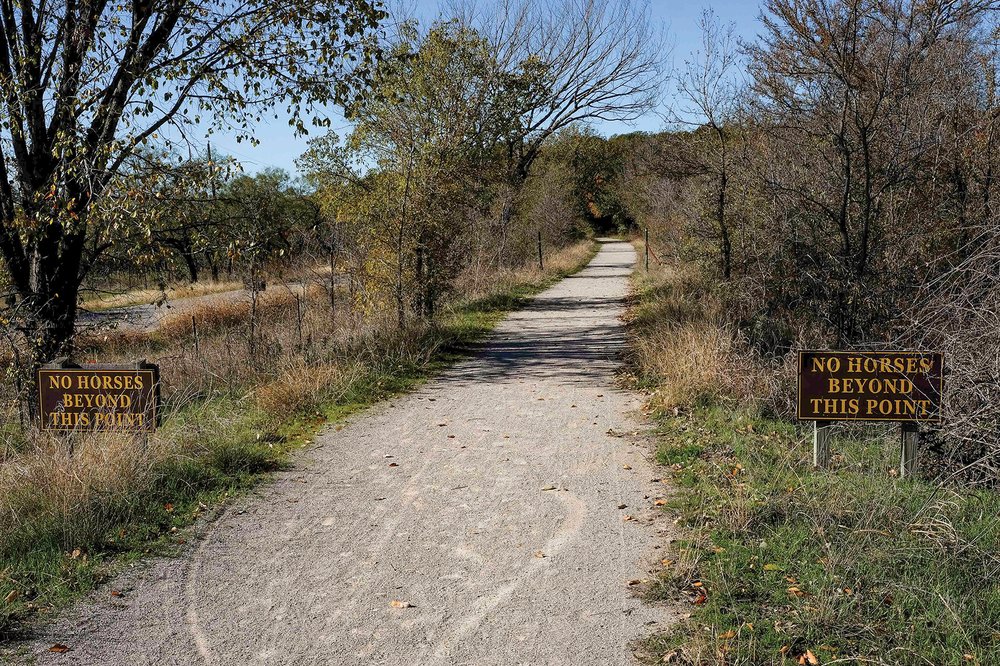
I was particularly intrigued to visit Caprock Canyons, a place I had not visited before. The state park, home to the state bison herd, resides in a scenic canyon setting and boasts nearly 90 miles of trails. The trailway, which is outside the main part of the park, stretches 64 miles from the town of South Plains, on top of the Caprock Escarpment, to Estelline, in the Red River Valley. The trail's most notable feature is the Clarity Tunnel, one of the last active railroad tunnels in the state.
Burlington Northern built this railroad in the early 1920s, and the rail line saw the clickety-clack of train traffic until 1989. With the help of the Rails-to-Trails Conservancy, TPWD acquired the 64-mile line in 1992.
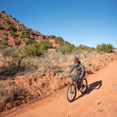
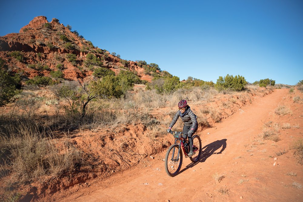
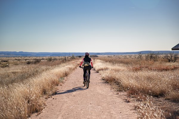
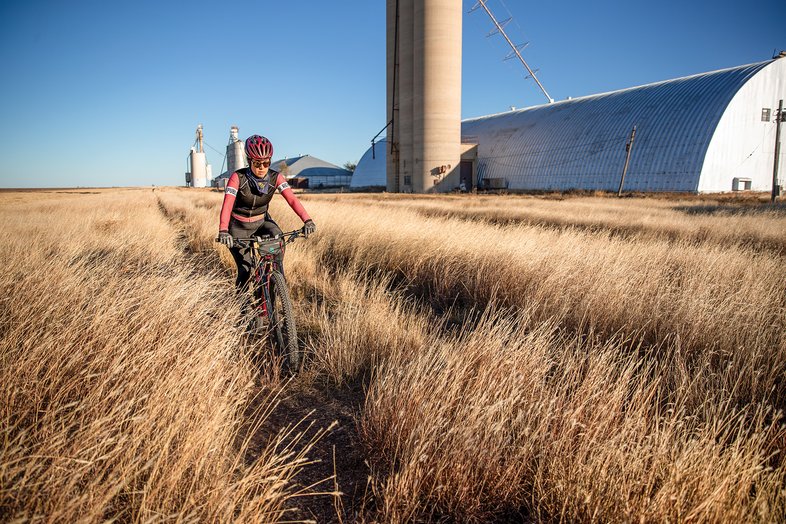
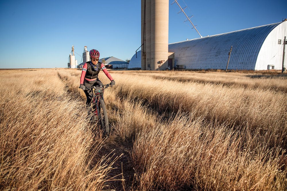
The trailway is divided into sections ranging from 5 to 17 miles. I wanted to see Clarity Tunnel, so I decided to ride the 17 miles from Monk's Crossing to South Plains. On a November morning, I strapped on my helmet, climbed aboard my mountain bike and headed west from the trailhead.
What I enjoyed most about the Caprock Canyons Trailway is how remote and scenic it is. The beauty of riding through the surrounding canyons is unmatched elsewhere in Texas. Along the way, I occasionally saw remnants of discarded railroad ties off to the side of the trail when I stopped to stretch my legs, take in the views of the canyons and the feel the absolute stillness of my peaceful surroundings.
Even though I feel logistical planning is my strong suit, I didn't pay enough attention to the wind patterns for the day and ended up with a headwind on my entire 17-mile ride. Along with the headwind, riding west-to-east presented me with a slight 7 percent uphill gradient climb. The wind and the incline left me feeling pretty tired at the end.
I found respite in the dark, temperate Clarity Tunnel, which sheltered me from the sun and wind. The 582-foot-long tunnel contains upwards of half a million Mexican free-tailed bats each summer, but alas, the bats were on holiday in Mexico, and I saw only a few stragglers. If you are a birder, don't forget your binoculars; 175 varieties of birds, including golden eagles and roadrunners, live in the area.
If riders start at Monk's Crossing and try to go east, they may find the trailway difficult to traverse. When I rode in November, the trailway was choked with tumbleweeds, mesquite, sagebrush and other desert flora. It's best to contact the park headquarters for an update on trail conditions before heading out.
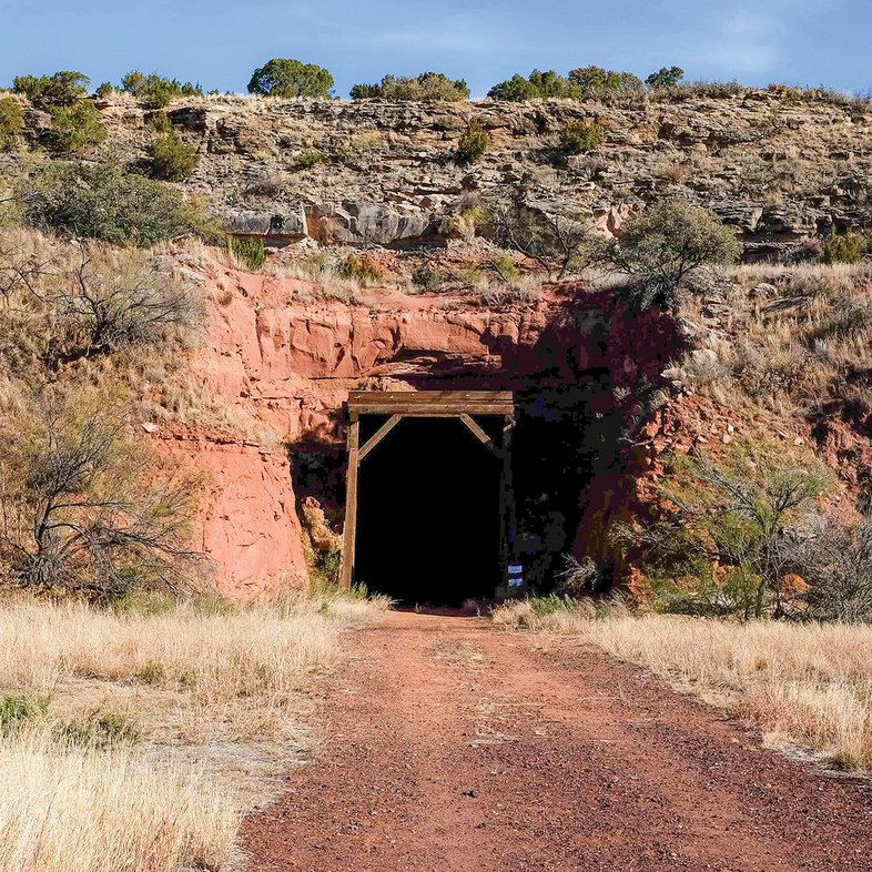
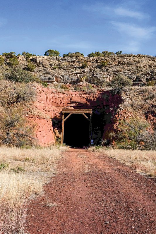
Clarity Tunnel
Clarity Tunnel
I had a great riding experience, however, going west from Monk's Crossing. Once I reached South Plains, magazine photographer Maegan Lanham was there to give me a ride back.
Wide tires on a bike are essential; I was on a mountain bike with 2.10-inch tires, which allowed me to ride over the loose, rocky (and sometimes sandy) terrain with little issue. Running a tubeless wheel setup is helpful in this terrain because there are many sharp, jagged thorns and rocks that can puncture bike tubes quickly. If you plan to run tires with tubes, look for the most flat-resistant tires you can find and look for inner tubes that use “slime” or some other type of liquid sealant inside of them.
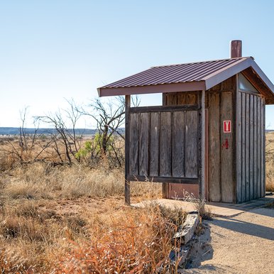
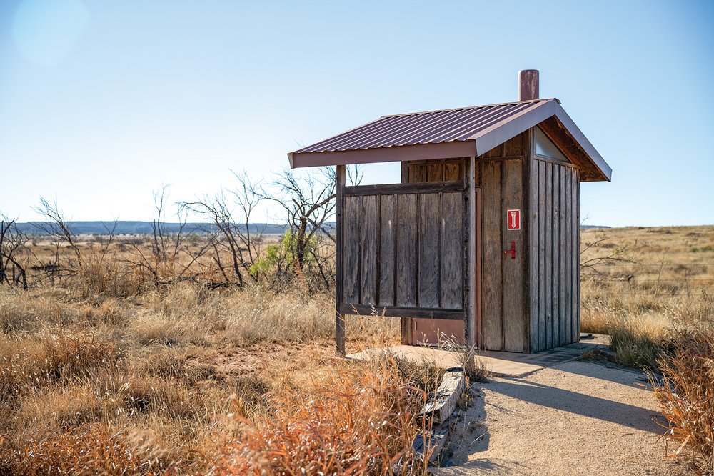
The Caprock Canyons Trailway offers no public resources other than a few shaded shelters and outhouses, so plan to bring all of your own water and bike tools. It's important to bring plenty of water. Camping is allowed along the trail although fires are not permitted; riders can pay $12 per night at the park headquarters. Permits are required along the trailways. They can be purchased (along with campsite reservations) online at TPWD's reservation website, texasstateparks.reserveamerica.com

Lake Minerals Wells
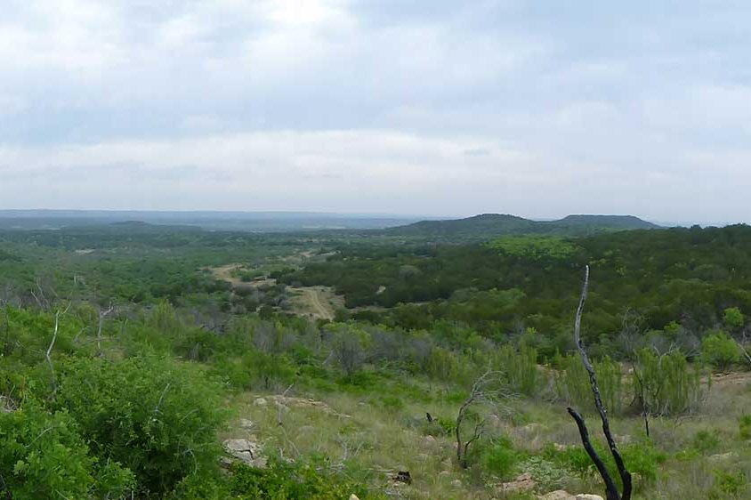
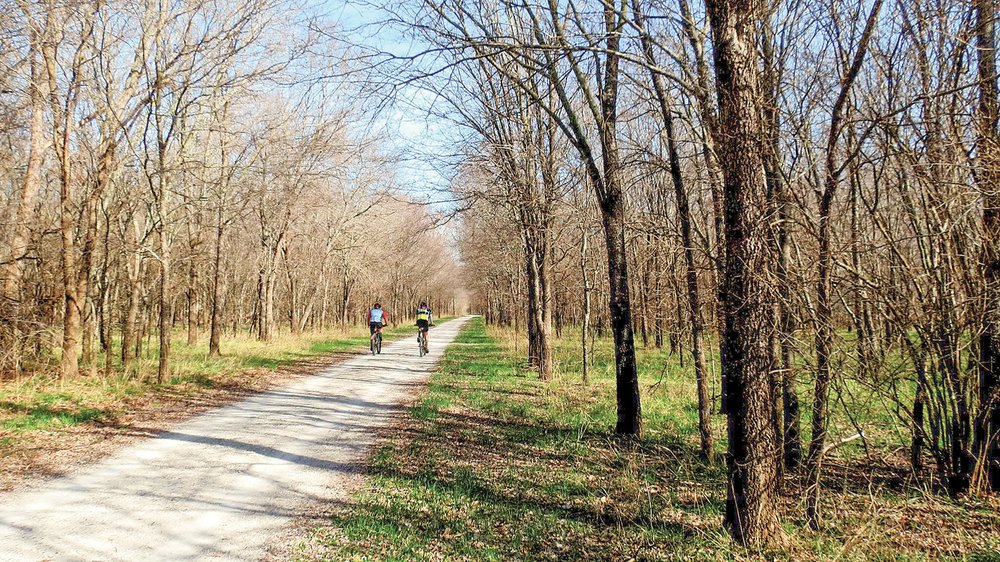
The second stop on my trailways tour took me to Lake Mineral Wells State Park. The trailway there runs 20 miles between the towns of Mineral Wells and Weatherford, with a connecting trail to the state park. Since the trailway is a reclaimed railroad bed, it has flat grades and gentle curves.
Trains once took thousands of visitors to Mineral Wells for the town's healing waters and mineral baths. At one point Mineral Wells boasted 40 hotels and 20 mineral water companies that supported the mineral water tourism of the time. Train service began in 1891, and lasted in various forms for 100 years, ending in 1992. The Lake Mineral Wells State Trailway opened on National Trails Day, June 6, 1998, as part of the 75th anniversary celebration of state parks.

“Now people can go the whole 20 miles biking, walking or even on horseback,” says David Owens, assistant park superintendent. “The trail is a different way to experience history because you are traveling the same route that people came in on to Mineral Wells. You're on that same route.”
I hopped on the trail at the state park with the goal of riding to Weatherford. I rode to the Lone Star Amphitheater just inside the park entrance to find the trailhead. Just after the trailhead, I encountered a steep and slightly loose decline for half a mile down to the official trailway.
At the main trailway, I could have headed west toward Mineral Wells (6 miles away) or east toward the Garner township (3 miles away) and Weatherford (14 miles away). I went east.
Along the Lake Mineral Wells Trailway, a finely crushed limestone pathway led me past picturesque pastures of horses and cows.
I encountered a few random, loose sandy sections and roots throughout the gentle, 1 percent gradient trail, but any biker with a wider tire can enjoy this relaxing, partially shaded ride; I rode the trail without hesitation on a gravel bike with wide tires.
I saw plenty of wildlife such as deer, rabbits and foxes and encountered a handful of trail users, including hikers and other cyclists. I enjoyed the interactive QR code signage on the trail provided free of charge through youraudiotour.com. The 15 QR signs provide an audible tour of the history of the area as well as notable locations on the trailway; these were in nice, shaded spots that allowed me to get off my bike, take a short break and snap a few photos. The incredible tree foliage added color to my ride. Texas doesn't experience much fall foliage, but our late November trip greeted us with vibrant shades of red, orange and yellow covering the lovely shade trees along the trailway.

Rider Brandon Walton of Azle has ridden the trail with his family. “It's very well marked, safe, good for the whole family,” he says. “It's a good way to utilize an old railway.”
The Garner trailhead contains restroom facilities, parking and a self-pay station. I did not see any water fountains along the trail; trail users should plan to bring their own water and bike tools.
I had a pleasant and rewarding riding experience on the Lake Mineral Wells Trailway to Weatherford; I'm thankful that Maegan was able to pick me up at the Weatherford trailhead and return me back to the state park.
Texas' two rail-trails did not disappoint — I hope to be back to ride the portions I did not get to this time. My experience reminded me of what I find so rewarding about these trails: the freedom of gliding across the Texas landscape and the beauty found in repurposing these trails for all to enjoy.
Other State Park Trails
Texas has almost 600 miles of bike-friendly trails in state parks. State park roads also provide safe and pleasurable riding experiences. Some of my favorite state parks for bike riding are McKinney Falls, Bastrop, Buescher, Dinosaur Valley, Huntsville, Lake Somerville and San Angelo. For longer state park rides, check out these two options.

Ray Roberts Lake State Park
This North Texas park offers a 10.5-mile multiuse Greenbelt Corridor that runs from Ray Roberts Dam to Lake Lewisville along the Elm Fork of the Trinity River. The trail, with dirt, gravel and paved sections, takes bikers, hikers and horseback riders through the Denton area's Cross Timbers habitat. Towering cottonwoods, sycamores, pecans and bur oaks make up the bottomland hardwood forest, interspersed with meadows. Note that the Ray Roberts greenbelt closer to U.S. Highway 380 is susceptible to flooding, so it's always a good idea to call the park headquarters to confirm trail conditions.

Fort Richardson State Park
The Lost Creek Reservoir State Trailway follows scenic Lost Creek to the east side of Lake Jacksboro and Lost Creek Reservoir. It crosses the dam at Lost Creek Reservoir, then winds along the west side until it reaches the trailhead at the North Park. The 9-mile hike, bike and horse trail allows users to experience wildlife, wildflowers and shaded areas of pecan and oak trees.